Hand-drawn maps of the attack on Pearl Harbor
- Title
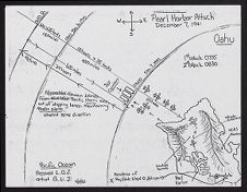
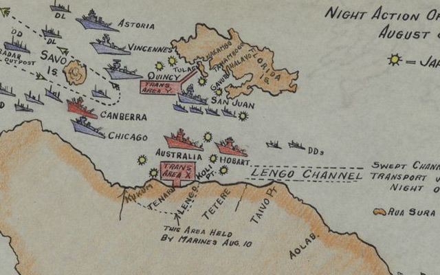
- Hand-drawn maps of the attack on Pearl Harbor
- Description
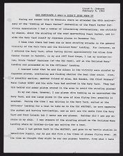
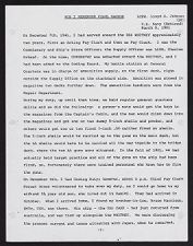
- Two maps drawn by hand in pen by artist G.L.J. and prepared by Lloyd O. Johnson, dated 4/10/82 . Johnson was the Commissary and Ship's Store Officer aboard the USS Whitney and was at home 12 miles away from Pearl Harbor on December 7th, 1941. Maps show the movement of the Imperial Japanese Navy Air Service on December 7, 1941 and the location of the United States Naval Ships that were docked at Pearl Harbor, with notes on damage, approximate times and distances, and the locations of other military bases and Johnson's home on Oahu.
- Date
- April 10, 1982
- Original Format
- drawings
- Extent
- 28cm x 21.7cm
- Local Identifier
- 0677-021-b1-fa
- Creator(s)
- Subject(s)
- Spatial
- Location of Original
- East Carolina Manuscript Collection
- Rights
-
This item has been made available for use in research, teaching, and private study. Researchers are responsible for using these materials in accordance with Title 17 of the United States Code and any other applicable statutes. If you are the creator or copyright holder of this item and would like it removed, please contact us at als_digitalcollections@ecu.edu.
http://rightsstatements.org/vocab/InC-EDU/1.0/ - Permalink
- https://digital.lib.ecu.edu/65648
- Preferred Citation
- Cite this item
- This item
-
 Hand-drawn maps of the attack on Pearl Harbor
- My Collections Login
- Printable Feedback Form
- Found in theme/project
-
 Military History
-
 Military History: World War II
-
 Naval and Maritime History
- Location of Original
- U.S. Navy Memorial Foundation Collection: Lloyd O. Johnson Papers from the East Carolina Manuscript Collection
- View all digitized items from the U.S. Navy Memorial Foundation Collection: Lloyd O. Johnson Papers
Related Search Results
Public access is provided to these resources to preserve the historical record. The content represents the opinions and actions of their creators and the culture in which they were produced. Therefore, some materials may contain language and imagery that is outdated, offensive and/or harmful. The content does not reflect the opinions, values, or beliefs of ECU Libraries.
Contact Digital Collections
If you know something about this item or would like to request additional information, click here.
Comment on This Item
Complete the fields below to post a public comment about the material featured on this page. The email address you submit will not be displayed and would only be used to contact you with additional comments or questions.