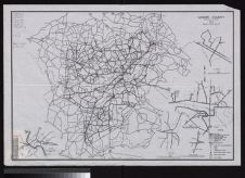
Map of Property of North Carolina State Highway & Public Works Commission, Harnett County
- Title
- Map of Property of North Carolina State Highway & Public Works Commission, Harnett County
- Description
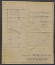
- Hand drawn blueprint map, by N. T. Smith, Registered Engineer, dated 10 November 1943 and revised several times until 1/15/61, of a 200.859-acre property in Harnett County, North Carolina. Land was used as a prison camp and farm known as "Cloister Crofts," which during World War II reputedly held Italian prisoners of war. The North Carolina State Highway & Public Works Commission acquired the land from Frances R. Ross on 27 March 1933. Diazotype. Scale: 1" = 300'. 18.5” x 21.5”. Marginal holograph note: "Harold Morgan File". Shows owners of surrounding land, including Bud Morgan.
- Date
- November 10, 1943 - January 15, 1961
- Original Format
- maps
- Extent
- 46cm x 54cm
- Local Identifier
- 0268-s3-ss5-sss2-b243-fc-i1
- Creator(s)
- Subject(s)
- North Carolina State Highway and Public Works Commission
- Harnett County (N.C.)--Maps
- World War, 1939-1945--Prisoners and prisons, American
- Spatial
- Location of Original
- East Carolina Manuscript Collection
- Rights
-
This item has been made available for use in research, teaching, and private study. Researchers are responsible for using these materials in accordance with Title 17 of the United States Code and any other applicable statutes. If you are the creator or copyright holder of this item and would like it removed, please contact us at als_digitalcollections@ecu.edu.
http://rightsstatements.org/vocab/InC-EDU/1.0/ - Permalink
- https://digital.lib.ecu.edu/56763
- Preferred Citation
- Cite this item
- This item
-
 Map of Property of North Carolina State Highway & Public Works Commission, Harnett County
- My Collections Login
- Printable Feedback Form
- Found in theme/project
-
 Military History
-
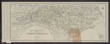
 Transportation
-
 Military History: World War II
-
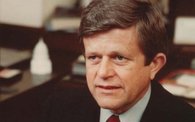 Senator Robert Burren Morgan
-
 Transportation: Auto
- Location of Original
- Robert Morgan Papers from the East Carolina Manuscript Collection
- View all digitized items from the Robert Morgan Papers
Related Search Results

Public access is provided to these resources to preserve the historical record. The content represents the opinions and actions of their creators and the culture in which they were produced. Therefore, some materials may contain language and imagery that is outdated, offensive and/or harmful. The content does not reflect the opinions, values, or beliefs of ECU Libraries.
Contact Digital Collections
If you know something about this item or would like to request additional information, click here.
Comment on This Item
Complete the fields below to post a public comment about the material featured on this page. The email address you submit will not be displayed and would only be used to contact you with additional comments or questions.