Themes & Projects
Browse
All Items
Divisions
Subjects
My Collections
Themes & Projects
About
Advanced Search
Help us improve our site.
Please take our survey
!
Digital Collections User Survey
×
Loading…
Home
Filtered search
FILTER SEARCH
Exclude Born Digital Content
DATE RANGE
to
Limit
ONLINE FORMAT
Image
17
Text
1
ORIGINAL FORMAT
maps
ORIGINAL FORMAT
×
ORIGINAL FORMAT
COUNT
maps
17
LOCATION
North Carolina
2
Pitt County (N.C.)
2
Bath (N.C.)
1
Greenville (N.C.)
1
Guadalcanal (Solomon Islands)
1
Maryland
1
South Carolina
1
More
LOCATION
×
LOCATION
COUNT
North Carolina
2
Pitt County (N.C.)
2
Bath (N.C.)
1
Greenville (N.C.)
1
Guadalcanal (Solomon Islands)
1
Maryland
1
South Carolina
1
Virginia
1
THEME/PROJECT
North Carolina Maps
8
African American History and Culture
2
Agriculture
1
Bath Tricentennial
1
ECU History
1
Military History
1
Military History: World War II
1
More
THEME/PROJECT
×
THEME/PROJECT
COUNT
North Carolina Maps
8
African American History and Culture
2
Agriculture
1
Bath Tricentennial
1
ECU History
1
Military History
1
Military History: World War II
1
Naval and Maritime History
1
North Carolina History and Fiction Collection
1
Politics and Government: North Carolina
1
Senator Robert Burren Morgan
1
Special Collections Staff Picks
1
Transportation
1
Transportation: Auto
1
SUBJECT
North Carolina--Maps--Early works to 1800
2
Bath (N.C.)--History
1
Bath (N.C.)--Surveys
1
Bath Creek (Bath, N.C.)
1
Coasts--North Carolina--Maps--Early works to 1800
1
Election districts--North Carolina--Greenville--Maps
1
Fire control (Gunnery)--Maps
1
More
SUBJECT
×
SUBJECT
COUNT
North Carolina--Maps--Early works to 1800
2
Bath (N.C.)--History
1
Bath (N.C.)--Surveys
1
Bath Creek (Bath, N.C.)
1
Coasts--North Carolina--Maps--Early works to 1800
1
Election districts--North Carolina--Greenville--Maps
1
Fire control (Gunnery)--Maps
1
Greenville (N.C.)--Maps
1
Guadalcanal (Solomon Islands)--History, Military--20th century--Maps
1
Maryland--Maps--Early works to 1800
1
Real property--North Carolina--Pitt County--Maps
1
Soils--North Carolina--Pitt County--Maps
1
South Carolina--Maps--Early works to 1800
1
Virginia--Maps--Early works to 1800
1
World War, 1939-1945--Campaigns--Pacific Area--Maps
1
World War, 1939-1945--Naval operations, American--Maps
1
DIVISION
East Carolina Manuscript Collection
14
Joyner NC Rare
1
Joyner NC Stacks
1
DIVISION
×
DIVISION
COUNT
East Carolina Manuscript Collection
14
Joyner NC Rare
1
Joyner NC Stacks
1
Filters
Search Results
17 results found for:
Jamison, James P.
Original Format:
maps
Sort by:
Relevance
Date Digitized
Date Created
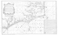
James Wimble's 1738 Map of North Carolina
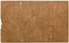
Map of Greenville, N.C. : population 1930-10,168, ...
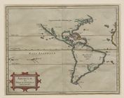
Americæ sive Indiæ occidentalis tabula generalis
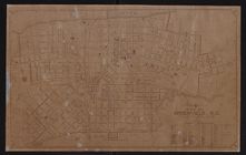
Map of Greenville, N.C.
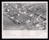
Shore Drive redevelopment project
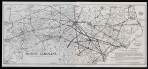
North Carolina highway system map
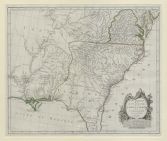
A new map of Carolina
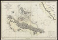
Guadacanal and Florida Is. with a portion of Malai...
Joyner Library on Alumni Day
Map of the British empire in America with the Fren...
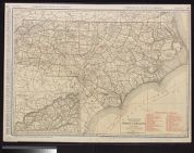
Standard map of North Carolina
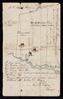
Surveyor's Map of W. H. Fortescue's Land in Hyde C...
N.C. R-15 Shore Drive Redevelopment Project in dow...
Partie meridionale de la Louisiane, avec la Florid...
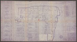
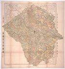
Soil map, North Carolina, Pitt County sheet
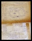
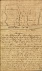
Survey of Bath Town Creek
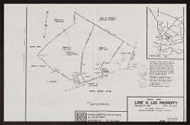
Sales Map for Luke H. Lee Property