
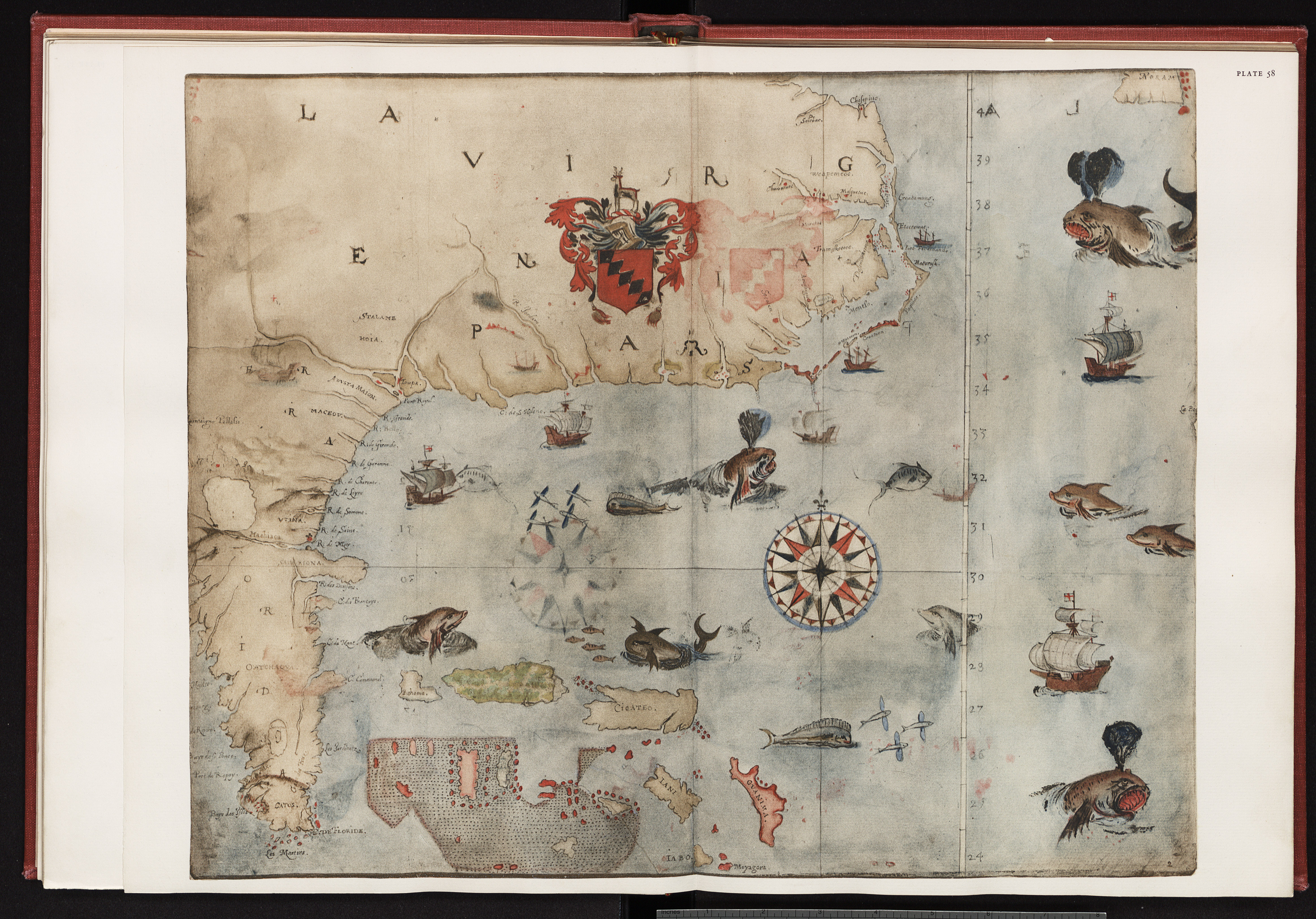
| Title | Port Fernando |
| Origtitle | John White North American map |
| Variants | Plate 58 |
| Caption | Port Fernando, the entrance found after sailing "a hundred and twentie English miles" |
| Source | 1964 John White Edition |
| Date | 1585-86 |
| Creator | Thomas Harriot & John White |
| Type | Watercolor |
| Origin | Scan of 1964 UNC Edition of drawings |
hundred and twentie English miles
AtlasMap of Eastern North America: Florida to Chesapeake Bay