
| Title | Wingandacoa |
| Origtitle | John White Outer Banks Map |
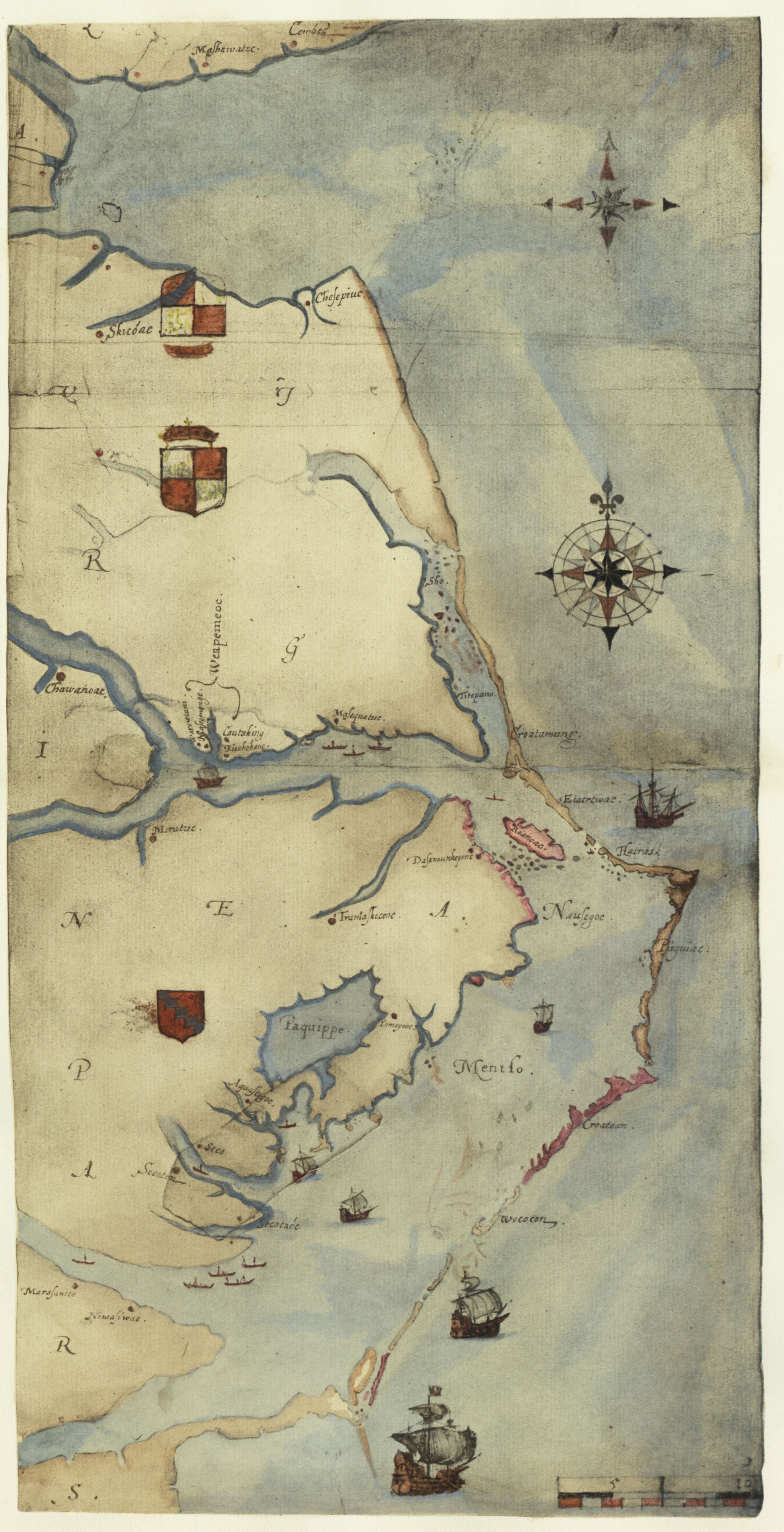
| Caption | Detail of White map |
| Source | 1964 John White Edition |
| Date | 1585-86 |
| Creator | Thomas Harriot & John White |
| Type | Watercolor |
| Origin | Scan of 1964 UNC Edition of drawings |
| Notes | Barlowe makes two separate references to the area of "Wingandacoa". He adds to one of these references by saying the territory is renamed "Virginia". Wingandacoa was the territory under the control of the King Wingina. This territory likely spanned Roanoke Island, a portion of the nearby mainland, and portions of nearby Outer Banks islands. |
Wingandacoa / Wingandacoa / Wingandacoa / Wingandacoa / Wingandacoa / Wingandacoa
Atlas Additional Notes
The name "Wingandacoa" functions as another name for the mainland of Virginia. It also can reference the land of Wingina.