
| Title | Chesepiok |
| Origtitle | Page 39 - Virginia - Right Side |
| Source | UNC German De Bry |
| Date | 1590 |
| Creator | Theodor de Bry (Engraver); John White (Artist) |
| Type | Engraving |
| Origin | UNC German De Bry |
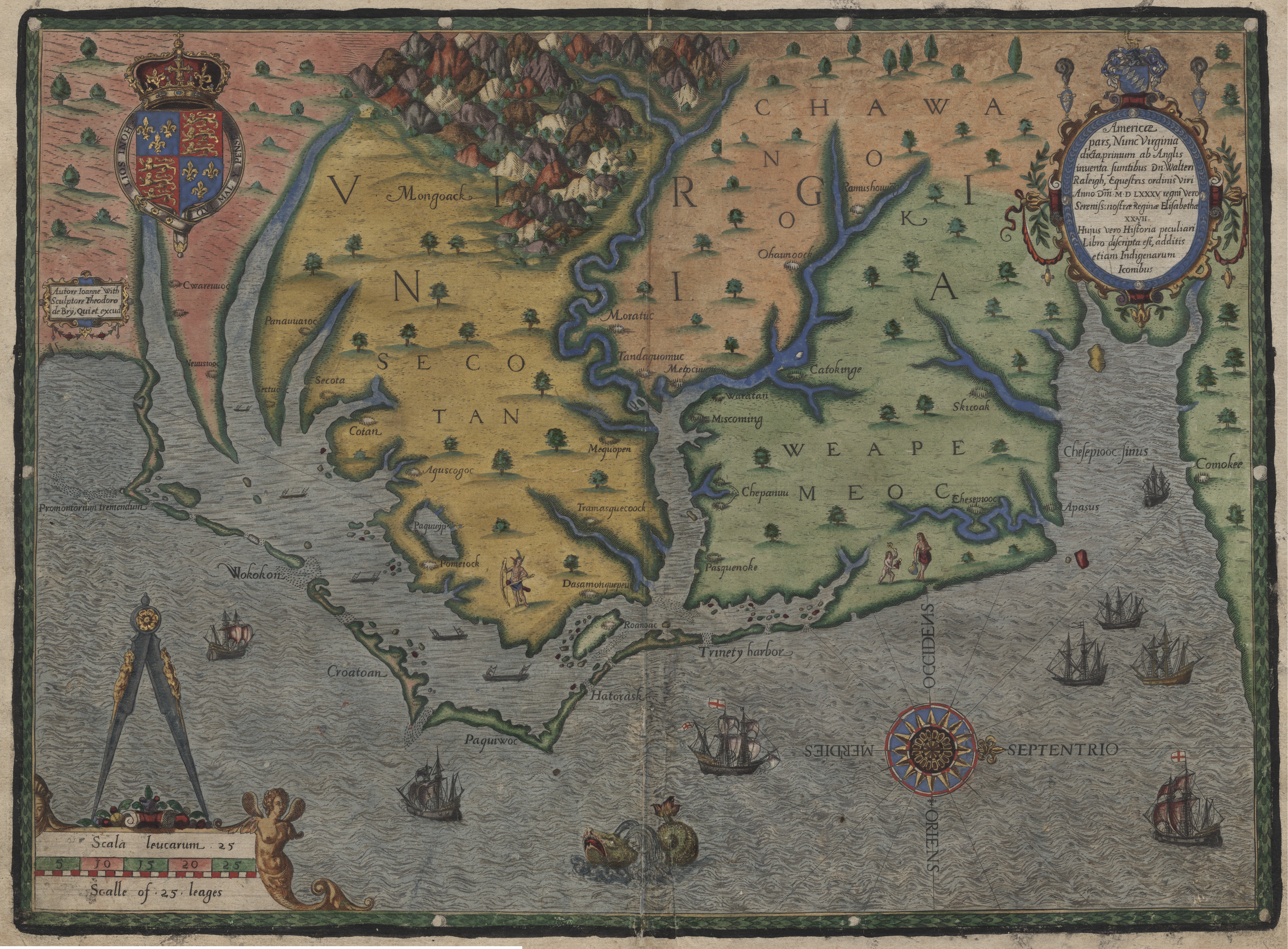
The principal settlement in the Chesepians' territory was Chesepiok, "being distant fifteene miles from the shoare" (Lane, p. 738). The DeBry map illustrates the settlement's location relative to the Chespeake Bay. Lane notes this was the furthest north they explored, about 130 miles from Roanoake to the Chesepians territory, and that "the passage to it was very shalow and most dangerous, by reason of the bredth of the sound". Judging by this passage in Lane (p. 738), and the White and DeBry maps, Lane's detachment likely explored up through Currituck Sound and what is now known as the North Landing River.