New & accurate chart of the Western or Atlantic Ocean : drawn from surveys and most approved maps & charts, the whole being regulated by astronomical observations
- Title
- New & accurate chart of the Western or Atlantic Ocean : drawn from surveys and most approved maps & charts, the whole being regulated by astronomical observations
- Description
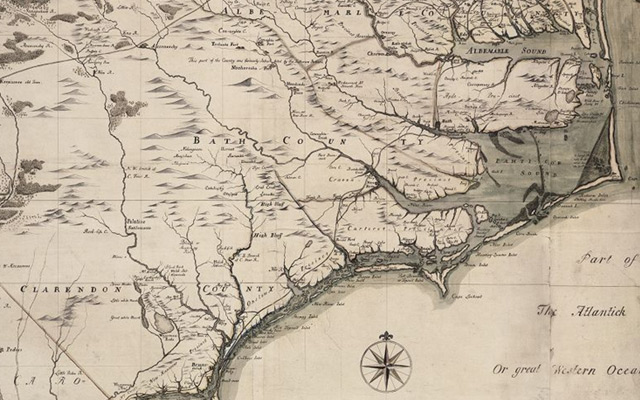
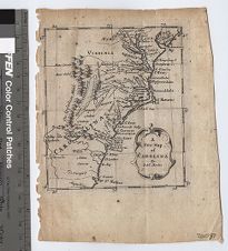
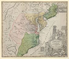
- A new & accurate chart of the Western or Atlantic Ocean : drawn from surveys and most approved maps & charts, the whole being regulated by astronomical observations / by Eman. Bowen, Geographer to His Majesty. [London] : [Printed for T. Woodward ... [et al.], 1744-1748]. 1 map : color ; 36 x 43 cm. Scale [ca. 1:23,000,000]. Map of the Atlantic Ocean showing the course of Columbus to the new world. Relief shown pictorially. In lower right margin: Vol. II. page 3. From: Navigantium atque itinerantium bibliotheca, or, A complete collection of voyages and travels / by John Harris. London : Printed for T. Woodward [and others], 1744-1748. "West longitude from London". Includes notes on ocean currents and trade winds.
- Date
- 1744-1748
- Original Format
- maps
- Extent
- 47cm x 40cm
- Local Identifier
- MC0037
- Creator(s)
- Contributor(s)
- Subject(s)
- Spatial
- Location of Original
- East Carolina Manuscript Collection
- Rights
-
This item has been made available for use in research, teaching, and private study. Researchers are responsible for using these materials in accordance with Title 17 of the United States Code and any other applicable statutes. If you are the creator or copyright holder of this item and would like it removed, please contact us at als_digitalcollections@ecu.edu.
http://rightsstatements.org/vocab/InC-EDU/1.0/ - Permalink
- https://digital.lib.ecu.edu/10388
- Preferred Citation
- Cite this item
- This item
-
 New & accurate chart of the Western or Atlantic Ocean : drawn from surveys and most approved maps & charts, the whole being regulated by astronomical observations
- My Collections Login
- Printable Feedback Form
- Found in theme/project
-
 North Carolina Maps
- Location of Original
- A New & Accurate Chart of the Western or Atlantic Ocean Drawn from Surveys and most approved Maps & Charts; The whole being regulated by Astronomical Observations from the East Carolina Manuscript Collection
- View all digitized items from the A New & Accurate Chart of the Western or Atlantic Ocean Drawn from Surveys and most approved Maps & Charts; The whole being regulated by Astronomical Observations
Related Search Results
![Sketch of Beaufort Harbor, North Carolina from a hydrographic reconnoissance by the party of J.N. Maffitt [and] A.D. Bache, Superintendent.](https://iiif.lib.ecu.edu/cantaloupe/iiif/2/00010452_0001.jp2/full/!225,225/0/default.jpg)
Public access is provided to these resources to preserve the historical record. The content represents the opinions and actions of their creators and the culture in which they were produced. Therefore, some materials may contain language and imagery that is outdated, offensive and/or harmful. The content does not reflect the opinions, values, or beliefs of ECU Libraries.
Contact Digital Collections
If you know something about this item or would like to request additional information, click here.
Comment on This Item
Complete the fields below to post a public comment about the material featured on this page. The email address you submit will not be displayed and would only be used to contact you with additional comments or questions.