Issued October 5, 1909. U. S. DEPARTMENT OF AGRICULTURE. BUREAU OF SOILS—MILTON WHITNEY, Chief. IN COOPERATION WITH THE NORTH CAROLINA DEPARTMENT OF AGRICULTURE, S. L. PATTERSON, DIRECTOR, B. W. KILGORE, STATE CHEMIST.
SOIL SURVEY OF ROBESON COUNTY NORTH CAROLINA.BY W. EDWARD HEARN,ASSISTED BY G. M. MACNIDER AND J. E. TURLINGTON, OF THE NORTH CAROLINA DEPARTMENT OF AGRICULTURE. [Advance Sheets—Field Operations of the Bureau of Soils, 1908.]United States Department of Agriculture 1862 Agriculture is the Foundation of Manufacture and Commerce 1889
Seal of the United States Department of AgricultureWASHINGTON:GOVERNMENT PRINTING OFFICE.1909.
[PUBLIC RESOLUTION—NO. 9.]
JOINT RESOLUTION Amending public resolution numbered eight, Fifty-sixth Congress, second session, approved February twenty-third, nineteen hundred and one, “providing for the printing annually of the report on field operations of the Division of Soils, Department of Agriculture.”
Resolved by the Scnate and House of Representatives of the United States of America in Congress assembled, That public resolution numbered eight, Fifty-sixth Congress, second session, approved February twenty-third, nineteen hundred and one, be amended by striking out all after the resolving clause and inserting in lieu thereof the following:
That there shall be printed ten thousand five hundred copies of the report on field operations of the Division of Soils, Department of Agriculture, of which one thousand five hundred copies shall be for the use of the Senate, three thousand copies for the use of the House of Representatives, and six thousand copies for the use of the Department of Agriculture: Provided, That in addition to the number of copies above provided for there shall be printed as soon as the manuscript can be prepared, with the necessary maps and illustrations to accompany it, a report on each area surveyed, in the form of advance sheets, bound in paper covers, of which five hundred copies shall be for the use of each Senator from the State, two thousand copies for the use of each Representative for the Congressional district or districts in which the survey is made, and one thousand copies for the use of the Department of Agriculture.
Approved March 14, 1904.
[On July 1, 1901, the Division of Soils was reorganized as the Bureau of Soils.]
Issued October 5, 1909. U. S. DEPARTMENT OF AGRICULTURE. BUREAU OF SOILS—MILTON WHITNEY, Chief. IN COOPERATION WITH THE NORTH CAROLINA DEPARTMENT OF AGRICULTURE, S. L. PATTERSON, DIRECTOR, B. W. KILGORE, STATE CHEMIST.SOIL SURVEY OF ROBESON COUNTY NORTH CAROLINA.BY W. EDWARD HEARN,ASSISTED BY G. M. MACNIDER AND J. E. TURLINGTON, OF THE NORTH CAROLINA DEPARTMENT OF AGRICULTURE. [Advance Sheets—Field Operations of the Bureau of Soils, 1908.]United States Department of Agriculture 1862 Agriculture is the Foundation of Manufacture and Commerce 1889Seal of the United States Department of AgricultureWASHINGTON:GOVERNMENT PRINTING OFFICE.1909.
LETTER OF TRANSMITTAL.
U. S. DEPARTMENT OF AGRICULTURE,
BUREAU OF SOILS,
Washington, D. C., April 15, 1909.
SIR: I have the honor to transmit herewith the manuscript report and map covering the soil survey of Robeson County, N. C., and to recommend their publication as advance sheets of Field Operations of the Bureau of Soils, 1908, as authorized by law.
This work was done in cooperation with the North Carolina Department of Agriculture and had the indorsement of Hon. H. L. Godwin, within whose district the survey lies.
Very respectfully,
MILTON WHITNEY,
Chief of Bureau.
Hon. JAMES WILSON,
Secretary of Agriculture.
CONTENTS| Page. | |
| SOIL SURVEY OF ROBESON COUNTY, NORTH CAROLINA. By W. EDWARD HEARN, assisted by G. M. MACNIDER and J. E. TURLINGTON, OF THE NORTH CAROLINA DEPARTMENT OF AGRICULTURE | 5 |
| Description of the area | 5 |
| Climate | 8 |
| Agriculture | 9 |
| Soils | 12 |
| Norfolk sandy loam | 14 |
| Norfolk fine sandy loam | 15 |
| Norfolk very fine sandy loam | 17 |
| Norfolk sand | 18 |
| Norfolk fine sand | 20 |
| Portsmouth sandy loam | 21 |
| Portsmouth fine sandy loam | 22 |
| Portsmouth loam | 23 |
| Orangeburg fine sandy loam | 24 |
| Swamp | 24 |
| Sandhill | 25 |
| Drainage | 26 |
| Summary | 27 |
| FIGURE. | |
| Page. | |
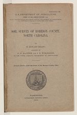
| FIG. 1. Sketch map showing location of the Robeson County area, North Carolina | 5 |
| MAP. | |
| Soil map, Robeson County sheet, North Carolina. |
SOIL SURVEY OF ROBESON COUNTY, NORTH CAROLINA.
By W. EDWARD HEARN, assisted by G. M. MacNIDER and J. E. TURLINGTON, of the North Carolina Department of Agriculture.
DESCRIPTION OF THE AREA.Robeson County lies in the southern part of the State of North Carolina, along the South Carolina line. It is bounded on the north by Cumberland County, on the east by Bladen and Columbus counties, on the south by the South Carolina State line, and on the
FIG. 1.—Sketch map showing location of the Robeson County area, North Carolina.
west by Scotland County. The county possesses a very irregular outline, following in most places the run of streams or the edge of swamp areas. It is the largest county in North Carolina, its greatest length from north to south being 52 miles, with a width varying from 25 to 37 miles. It has an area of 1,058 square miles or 677,120 acres.
The general surface features consist of level, undulating, gently rolling, and rolling areas, intersected by strips of swamp following the streams and dotted by many slight depressions and bays. The general slope of the county is to the south and southwest, and the difference in elevation of the two ends of the county is considerable.
The largest level areas occur around Pembroke and in what is known as “Scuffle Town,” in the vicinity of Bowmore, Dundarrach, to the southeast of Maxton, south and east of Lumberton, around Raynham, and to the west of Marietta. The surface of much of the county is undulating and very gently rolling, this being especially true around Rowland, Maxton, Red Springs, Parkton, McDonald, and Lumberton. The more rolling areas are found in the northwest corner along Lumber River, Rockfish Creek, and Big, Raft, and Ashpole swamps. No part of the county, however, is too rough or sufficiently broken to interfere with cultivation. The flattest and lowest areas occur along Lumber River in the southern part, where the largest bodies of swamp are found. The “Desert” is a conspicuous part of the topography, being an old lake practically surrounded by a ridge of sand. Many of the interstream areas are flat or undulating, becoming rolling as the streams or swamps are approached.
The regional drainage of the county is effected mainly through Lumber River, which forms a part of the western boundary, then flows across the county, and finally forms a part of the eastern boundary. Rockfish Creek flows along the northern end of the county. Big Swamp, Little Marsh, Big Marsh, and Ten Mile Swamp drain the northeastern and eastern parts of the county, while Big Raft, Little Raft, Richland, Long, Gum, Bear, and Back swamps drain the central part, the waters of all these emptying into the Lumber River. The southern and southwestern parts of the county are drained mainly by Leach and Shocheel creeks, and Aaron, Hog, Indian, and Ashpole swamps. Lumber River and many of the other streams are swift flowing for such a flat country. Along the swamps are many dirt dams, which form ponds of varying sizes. There are 35 such ponds in Robeson County, and at 33 of them grist mills are operated by water power. At a few of these places some cotton is ginned and lumber sawed.
Robeson County was formed in 1786 from Bladen County, and named in honor of Colonel Robeson, who distinguished himself in the battle of Elizabethtown. The population consists of three separate and distinct races, the whites, the Croatans, and the negroes. The majority of the first white settlers were Scotch, and they located principally in the northern and western parts of the county. There were also some of English descent. The Croatans came from eastern North Carolina about 250 years ago and settled along Lumber River. These are said to be a mixed breed in which Indian blood predominates. It is asserted that a part of the “lost colony” left by Governor White on Roanoke Island, mixed with the Croatan Indians, and dwelt on the Neuse River until they moved to Robeson County. These people were declared a distinct and separate race by an act
of the legislature in 1886. They have separate schools and churches, and have made wonderful progress within the last twenty-five years. They number 3,500 or 4,000, and live almost exclusively in the section in which Pembroke is located, thus occupying one-eighth or more of the county.
Probably not more than 30 per cent of the land in Robeson County is under cultivation. The largest percentage under cultivation lies around Rowland, McDonald, Red Springs, and Maxton. If all the swamps and depressions were drained there would be but little if any waste land, and if all the arable land were properly cultivated Robeson County could easily support several times its present population, which is about 45,000. Throughout the county are to be seen many neatly painted houses and other improvements which indicate, to a certain degree, the prosperity of the inhabitants. The farmers and landowners have made money in cotton and tobacco, and also on truck crops within the last few years. Much improved machinery, especially for cotton farming, is in use in the county.
Lumberton, the county seat, with a population near 4,000, is the principal town. Maxton and Red Springs have about 1,200 inhabitants each, Fairmont and Rowland about 800 each, while Parkton, Orrum, McDonald, Pembroke, Lumber Bridge, and St. Pauls are towns of less importance. Many smaller places and sidings for shipment of freight and express are conveniently located along the railroads.
Robeson County is well supplied with railroad facilities. It has the distinction of having as many different lines as any county in the State. The main line of the Atlantic Coast Line Railroad passes through the center of the county in a general northeast and southwest direction; the Bennettsville Branch of this system extends southwest from Parkton, crossing the county line near Maxton; the Southeastern Railroad, also a part of the Coast Line system, runs southwest from Elrod by Fairmont and thence east out of the county; the Aberdeen and Rockfish Railroad makes a swing into the northern part of the county; the Raleigh and Charleston Railroad runs south from Lumberton through the county; the Virginia and Carolina Southern Railroad extends north from Lumberton by St. Pauls; and the Wilmington and Charlotte Branch of the Seaboard Air Line Railway passes in a general east and west direction across the county.
The dirt roads are in fairly good condition. They have been worked in some townships by taxation. Good roads can be maintained in all parts of the county by a judicious mixing of the sand and clay materials at hand and by keeping the roadbed well rounded, so that the rain water will readily run off. Practically all of the county is well served by rural free delivery of mail. Neat schoolhouses and churches are to be seen throughout the rural districts.
While there are no cities in the county, the towns afford good markets for many of the products. Tobacco warehouses are in operation at Lumberton and Fairmont, and more than a million pounds of tobacco is annually sold at each place. All the towns are markets for cotton. Watermelons, cantaloupes, and early truck of all kinds are shipped to northern markets, mostly to Baltimore, Washington, Richmond, Philadelphia, Pittsburg, and New York.
CLIMATE.The climate of Robeson County is quite similar to the climate of a large portion of the Coastal Plain region. The winters are short and mild, while the summers are long and hot. Light snows fall nearly every winter, but rarely remain for more than a day or two. The spring and fall seasons are pleasant, and mild weather usually continues till Christmas. The prevailing breeze in the summer is from the south and southwest. It is generally conceded that the artesian water, pump water, and the drainage of certain wet areas have added greatly to the general healthfulness of the county.
The following table, compiled from the records of the Weather Bureau observer at Lumberton, gives the normal and absolute maximum and minimum monthly and annual temperatures, the mean monthly and annual precipitation, as well as the amount for the driest and wettest years, and also the average depth of snow. The rainfall is so distributed that the crops seldom suffer from severe drought and never fail to produce fair yields. The average date of the last killing frost in the spring is April 4 and of the first in the fall November 2. This gives a growing season of about seven months for the tenderest vegetation.
| Normal monthly, seasonal, and annual temperature and precipitation at Lumberton. | |||||||
| Month. | Temperature. | Precipitation. | |||||
| Mean. | Absolute maximum. | Absolute minimum. | Mean. | Total amount for driest year. | Total amount for wettest year. | Snow, average depth. | |
| °F. | °F. | °F. | Inches. | Inches. | Inches. | Inches. | |
| December | 44 | 74 | 13 | 3.1 | 3.3 | 5.6 | 0.5 |
| January | 43 | 76 | 8 | 4.0 | 2.2 | 4.0 | 1.9 |
| February | 41 | 74 | 1 | 4.9 | 5.9 | 2.2 | 2.9 |
| Winter | 43 | 12.0 | 11.4 | 11.8 | 5.3 | ||
| March | 53 | 85 | 18 | 3.7 | 2.5 | 3.6 | T. |
| April | 61 | 92 | 32 | 4.1 | 3.0 | 4.2 | T. |
| May | 71 | 98 | 39 | 4.3 | 3.4 | 12.5 | 0.0 |
| Spring | 62 | 12.1 | 8.9 | 20.3 | T. |
| Normal monthly, seasonal, and annual temperature, etc., at Lumberton—Cont'd. | |||||||
| Month. | Temperature. | Precipitation. | |||||
| Mean. | Absolute maximum. | Absolute minimum. | Mean. | Total amount for driest year. | Total amount for wettest year. | Snow, average depth. | |
| °F. | °F. | °F. | Inches. | Inches. | Inches. | Inches. | |
| June | 77 | 101 | 50 | 5.3 | 2.3 | 5.5 | 0.0 |
| July | 80 | 102 | 55 | 5.8 | 2.6 | 6.5 | 0.0 |
| August | 79 | 101 | 53 | 6.0 | 4.5 | 7.0 | 0.0 |
| Summer | 79 | 17.1 | 9.4 | 19.0 | 0.0 | ||
| September | 72 | 97 | 35 | 3.9 | 3.3 | 9.4 | 0.0 |
| October | 62 | 92 | 29 | 3.5 | 4.4 | 1.2 | 0.0 |
| November | 52 | 82 | 15 | 2.4 | 4.3 | 1.0 | 0.0 |
| Fall | 62 | 9.8 | 12.0 | 11.6 | 0.0 | ||
| Year | 61 | 102 | 1 | 51.0 | 41.7 | 62.7 | 5.3 |
The agricultural products and methods of cultivation in Robeson County have changed decidedly within the last half century. In the early days of settlement many of the swamps were canebrakes, much wild peavine hay was seen, and many cattle were raised. About fifty-five years ago corn, rye, and flax were the principal crops, while some wheat and barley were also produced. Tobacco has always been grown, for a long time by the Croatans for home use. The turpentine industry was important about fifty years ago, and continued so for a good while, but in recent years it has declined as the timber was cut, until now only a few small stills are in operation in the county. Cattle, hogs, and sheep were raised in great numbers before the civil war. Considerable wool was shorn and marketed. Rice was one of the important crops for many years. The lumber industry was at its best about twenty-five years ago, the cutting of the forests of longleaf pine bringing a large revenue to the mill operators and owners. As the forest was cut, more land was cleared and brought under cultivation.
Soon after the war cotton became the staple money crop. About 1896, after cotton had been selling at a very low price for a few years, the farmers were eager to introduce some other money crop, and they began to grow bright-yellow tobacco on a commercial scale. Most of the tobacco has been grown by the small farmers or by those who live on the farm and superintend the work. Tobacco has been grown around Fairmont about ten years. At first the entire stalk was cut, but a few years ago the method was abandoned and the leaves are now pulled off as they ripen and are cured by artificial heat. The old method of cutting the entire stalk was not the best, because not
all the leaves ripen at the same time, and consequently some would be overripe, while others would be green.
Most of the timber in Robeson County has been cut and only small tracts of the original growth occur here and there. There is a second growth coming on very fast, while most of the old growth remains in the swamp areas, which are thickly forested. Many sawmills are in operation throughout the county. There are large areas of cutover, undeveloped land. In the past few years the trucking industry has become of considerable importance.
Robeson County produces more cotton than any other county in the State. Its production for 1907 was something over 47,000 bales. Cotton is grown upon all soils and in all parts of the county. Next in importance is corn, which is widely grown. The tobacco is confined to the eastern and southern parts of the county, between Lumberton and St. Pauls, and around Ashpole and Orrum. The average price is from 7 to 10 cents per pound, and about 2½ million pounds are sold annually at Lumberton and Fairmont. Oats are grown to a small extent. Sweet potatoes are grown for home use and local markets and some for shipment. Irish potatoes are produced in certain parts of the county for early shipment and for home use generally. One field of asparagus was seen just south of Maxton. From Maxton to Parkton along the railroad, especially around Lumber Bridge, watermelons, cantaloupes, English peas, sweet corn, beans, and tomatoes are grown for early shipment. Some cowpeas are grown with good results. Garden vegetables are produced around every home, the Norfolk soils and climate of this section being particularly suited to them. Peaches, pears, mulberries, and a few apples are grown. The Scuppernong grape, first cultivated by the Croatans, is now grown all over the county. A considerable income is still derived from the sale of lumber and shingles. The shingles are made from cypress or from the heart of dead pines.
Throughout the northeast and southern parts of the county the Norfolk sandy loam and the Norfolk fine sandy loam, where it has a depth of 15 to 20 inches above the sandy clay subsoil, are recognized as the best soils for tobacco. The Norfolk very fine sandy loam is devoted almost entirely to cotton and corn. The truck crops are grown on the lighter and deeper phases of the Norfolk sandy loam and to some extent on the Norfolk sand. Scuppernong grapes do well on the Norfolk soils, and, like peaches, do best on well-drained soils. Some of the well-drained Portsmouth soils, especially the sandy loams, are recognized as good soils for corn, oats, and cotton. Peanuts, a crop not grown at present, would prove very profitable and would help to make a complete rotation with tobacco, cotton, and corn. Ribbon cane would do well on some of the soils which are in a high state of cultivation. In many localities all the staple
crops are grown upon the same type of soil, regardless of its adaptability to these crops.
The soils and climate of Robeson County are such that a variety of crops can be successfully grown, and a systematic rotation can be practiced. Cotton, especially on many of the larger plantations where the tenant system prevails, is grown year after year on the same land. Some of the farmers, however, rotate their crops by cultivating cotton two years, corn one year, and oats one year, sowing cowpeas at the last plowing of the corn and also after the oats are harvested. In the tobacco section more of a rotation is practiced, as usually only a few acres of each farm are devoted to tobacco. A good rotation would be cotton, peanuts, corn, and oats, sowing cowpeas at last plowing of corn and also after the oats are harvested.
The agricultural methods in Robeson County are being improved each year. Much modern machinery is now in use, such as cotton planters, fertilizer distributers, sulky plows, and cultivators for cotton and corn. Tobacco transplanters should be used by the farmers who grow tobacco, as they would save a great deal of hard labor. The Norfolk sand and Norfolk fine sand are so loose and open that the present methods serve fairly well. The Portsmouth soils, the Norfolk very fine sandy loam, and the heavier phases of the Norfolk sandy loam and Norfolk fine sandy loam should be plowed deeper and pulverized more thoroughly before the seed is planted. Some of the best farmers have found that this practice pays well. The old method of cultivating corn with a 1-horse plow, which necessitates hand hoeing, should be abandoned and improved cultivators used.
There is a general scarcity of efficient labor throughout the county. Most of the labor is performed by the negroes and Croatans. The Croatans are industrious workers and make fairly good tenants when supervised. The ordinary farm hand receives $15 a month with board, house, and garden patch. Many colored women work in the field and receive about 50 cents a day for chopping cotton. The men are paid from 75 cents to $1 a day for farm work.
A large proportion of the cultivated land in the county is worked by tenants, and these rent mainly under the share system. Under this system the landowner furnishes the land and all the fertilizers, and the renter furnishes the stock and implements, and does all the work, each receiving one-half of what is produced. Many of the landowners live in the towns. Perhaps a third of the tenants pay a stipulated rent, generally about a 500-pound bale of cotton for every 10 acres, though the amount depends on the quality of the land. On some of the farms the owners hire help and till their own land. Most of the small farms and some of the larger ones are operated directly by the owners.
The size of the farms varies from 50 to several hundred acres. On the southwest corner and in certain sections north of Lumberton the size ranges from 100 to 300 acres, while in other sections many smaller farms are common, especially among the Croatans.
Land values have greatly increased in Robeson County within the last few years. Much of the best improved land around Red Springs, Maxton, Rowland, and Lumberton is held at from $40 to $100 an acre; around Fairmont and in many other sections from $20 to $35 an acre; while the cut-over land, with its stumps and scattering growth, will sell from $8 to $12 an acre.
The soils in Robeson County are heavily fertilized. Many of the renters and small farmers buy a complete fertilizer, either 2-8-2a or 3-8-3, while some of the largest planters buy cotton-seed meal, acid phosphate, and kainit and do their own mixing. As a rule, from 400 to 800 pounds per acre is applied. From 600 to 800 pounds per acre of an 8-5-7 fertilizer is used on watermelons, cantaloupes, beans, peas, Irish potatoes, and other truck crops. More cowpeas should be grown in order to supply humus to the soil. This would also obviate the necessity of buying so much high-priced nitrogenous fertilizer and would save thousands of dollars, at the same time greatly improving the land. More machinery could be used advantageously. A systematic rotation of crops should be practiced whenever conditions warrant. Peanuts can be grown profitably in the rotation as a money crop. Deeper plowing and a better preparation of the land would give increased yields. Every farmer should produce sufficient corn and hay for feeding stock, and more hogs should be raised. Cowpeavine hay is an excellent feed for all stock. Robeson County offers great opportunities, and the present tendency is toward a higher development of its agricultural interests.
SOILS.Robeson County lies within the Atlantic Coastal Plain region. The entire area is covered by the Columbia formation, but in a few spots in the southern part near Rowland this formation is very thin and the outcropping of the Lafayette formation is seen, thus giving rise to small spots of Orangeburg fine sandy loam with its distinctly red subsoil. The Columbia formation consists of sands, sandy loam, silts, and clays. The materials were brought down by the streams from the Piedmont Plateau and deposited in the sea when this portion of North Carolina was covered by the Atlantic Ocean. Wave action has played an important part in sorting and redepositing the different grades of soil material; thus the stream currents and waves account largely for the occurrence of soils of different texture in the
a Formulas stated in this order: Nitrogen, phosphoric acid, potash.county. In the southern and southeastern parts of the county the soils are finer in texture than those in the northern and western parts.
The large areas of swamp are composed of these materials which have been transported and deposited by the streams during periods of overflow. Many of the sand areas have also been formed by deposits from the swift currents of the streams. The Sandhill and perhaps portions of the sand areas have been thrown up by wave and wind action. Many of the cypress bays and other depressions and the “Desert” were small lakes which were cut off by ridges of sand and thus separated from the main drainage ways. Erosion has played little part, except on the rolling areas and slopes where an appreciable amount of the finer material has been washed out.
In the southern part of the county shell marl occurs in many places at from 4 to 8 feet below the surface. Some of it has been used as fertilizer in recent years along Wilkinson Swamp and about 1½ miles east of Ashpole. Artesian water can be had at from 90 to 150 feet over a large part of the county, especially around Fairmont, Lumberton, and Fairbluff, and to the north of Lumberton.
The sedimentary soils in Robeson County are typical of the soils of the Atlantic and Gulf coastal plains. These soils have been classed into two distinct series—the Norfolk and the Portsmouth. The Norfolk series comprises the light-colored soils, underlain by yellow or brown sand, sandy clay, or loam. By reason of their topographic position the surface drainage is fairly good. The Portsmouth series comprises the dark-colored and black soils which are underlain by mottled gray sandy clay and clay. They occupy the level and depressed areas and have very poor natural surface drainage, being in many places in a semiswampy condition. The Portsmouth soils are derived from the same kind of material as those of the Norfolk series. They have been for a long time in a semiswampy condition which has favored the accumulation of large quantities of vegetable matter, and this has given them their dark color.
Eleven distinct types of soil were mapped in the county. Among these are included Sandhill and Swamp, which under present conditions are nonagricultural types. The following table gives the name and extent of each of the several types of soil:
| Areas of different soils. | |||||
| Soil. | Acres. | Per cent. | Soil. | Acres. | Per cent. |
| Norfolk sandy loam | 297,152 | 43.8 | Norfolk fine sand | 9,280 | 1.3 |
| Swamp | 108,800 | 16.6 | Portsmouth loam | 2,624 | .3 |
| Norfolk fine sandy loam | 105,920 | 15.6 | Orangeburg fine sandy loam | 1,536 | .2 |
| Portsmouth sandy loam | 62,080 | 9.1 | Sandhill | 960 | .1 |
| Norfolk sand | 51,648 | 7.6 | |||
| Norfolk very fine sandy loam | 26,880 | 3.9 | Total | 677,120 | |
| Portsmouth fine sandy loam | 10,240 | 1.5 |
NORFOLK SANDY LOAM.
The surface soil of the Norfolk sandy loam consists of a gray, yellowish-gray, or light-brown, medium to coarse sandy loam, varying in depth from 8 to 30 inches. It is locally spoken of as “gray land.” Around Pembroke and in the vieinity of Bowmore the soil is a gray, medium to coarse sandy loam, about 8 to 12 inches deep. In a few of the low-lying forested areas the first few inches is dark gray in color, due to the accumulation of vegetable matter, while on some of the ridges which have been cultivated for a long time the soil is light colored. A considerable portion of the surface soil is light brown in color. Along Lumber River and in the southwest corner of the county and near many of the swamps and streams a rather coarse sandy loam is found. Between the gray or brown surface soil and the yellow, sandy clay there is a stratum of yellow medium to coarse, sandy loam. This soil is cultivated with ease and its position allows the use of modern machinery for practically all areas. Over the larger and more uniform areas the subsoil is a yellow, sticky, sandy clay, and in a few localities it is a yellow, sticky, sandy loam, especially sandy near the areas of Norfolk sand. A reddish-yellow or brown sandy clay was seen in a few places near the streams. Near the river and other large streams some coarse sand and fine gravel are mixed with the sandy clay.
The Norfolk sandy loam is the most important and most extensive type in the county, covering about 44 per cent of the area. It is the principal soil in the northern, central, and western parts of the county. It is typically developed around Parkton, Dundarrach, Bowmore, Red Springs, Maxton, Pembroke, St. Pauls, north and west of Company Mills, along the Coast Line Railroad from Pembroke north, and along the Seaboard line from Maxton to near Lumberton. A large area occurs south of Lumberton, in Britt Township, and a large body follows Ashpole Swamp.
The surface features of the type vary from level and undulating to rolling areas. The largest, flattest areas occur in the vicinity of Pembroke, throughout part of “Scuffle Town” around Bowmore, southeast of Rennert, west of Dundarrach, and southeast of Maxton. The main interstream areas are usually flat and undulating, with a gradual slope toward the streams, becoming more rolling as the swamps and streams are approached. Open ditches have been cut and are in general use over these flat areas. More of these artificial drains are needed to drain thoroughly and dry out the soil for cultivation. Most of the undulating and all the rolling areas possess good natural surface drainage. All of this type could be artificially drained and brought under cultivation. Much of the land now tilled would be greatly benefited by better drainage.
The Norfolk sandy loam is sedimentary in origin and is derived from the weathering of the sands and clays of the Columbia formation. On the gently rolling areas and slopes the material has been subjected to considerable washing and the rain waters have carried away a large amount of the finer material, leaving a deep, light sandy loam, while on the more level areas the soil contains a larger proportion of clay and is slightly more compact. The forest growth at present is longleaf, loblolly, and shortleaf pine, with some scattering dogwood, hickory, and oak. Very little of the merchantable longleaf pine now remains.
The Norfolk sandy loam is the best general farming soil in the county. It is well adapted to the production of cotton, peanuts, tobacco, Irish potatoes, sweet potatoes, corn, and cowpeas. The truck crops, such as watermelons, cantaloupes, beans, English peas, tomatoes, sweet corn, and asparagus do well on the lighter and deeper phase of this type. It is a good soil for the Scuppernong and other grapes, peaches, pears, and mulberries. Cotton yields from one-third bale to 1¼ bales to the acre, the average yield by tenants being about one-half bale. The largest yields are secured by good cultivation and heavy applications of fertilizer. Corn yields from 10 to 40 bushels per acre, sweet potatoes from 50 to 200 bushels, tobacco from 700 to 1,400 pounds, and oats from 20 to 40 bushels. Watermelons, cantaloupes, Irish potatoes, English peas, beans, tomatoes, and sweet corn are grown with a fair degree of success around Maxton, Lumber Bridge, and Parkton for early shipment. The truck crops are heavily fertilized, and also the tobacco and most of the cotton. For watermelons 7-8-5 grades are used and for sweet potatoes the 3-8-3, the latter being used also for tobacco and part of the cotton.
The soil needs to be plowed deeper and pulverized more thoroughly before the seed is planted. It holds manures fairly well and can be easily maintained in a state of high productiveness. By plowing under cowpeas and coarse manures and adopting a systematic rotation of crops this soil would soon produce good yields without much commercial fertilizer. A little lime would probably prove beneficial, especially if peanuts were grown.
The Norfolk sandy loam brings from $20 to $30 an acre in remote sections of the county, while near Red Springs, Maxton, and Parkton it sells at from $30 to $75 an acre.
NORFOLK FINE SANDY LOAM.The Norfolk fine sandy loam to a depth of about 6 inches is a gray or yellowish-gray fine sandy loam, grading into a yellowish fine sandy loam which extends to a depth of 10 to 30 inches. In the forested areas the first few inches of soil is dark gray in color, owing
to the accumulation of considerable organic matter. The average depth of the fine sandy loam surface is about 12 or 15 inches, and the yellow stratum is always encountered before the sandy clay is reached. In a few localities a light brown fine sandy loam is seen. In addition to the typical soil there are two noticeable phases. Around Rowland where this type joins the Norfolk very fine sandy loam, around Barnesville, and to the south of Orrum, the soil is slightly heavier in texture and the subsoil is nearer the surface than the average of the type. This phase is considered by some as the best part of the type. To the north of Orrum, east of Fairmont, and several miles northeast of Lumberton, in the “meadow section,” the soil is from 20 to 30 inches deep, being a light, fine sandy loam, and not quite so productive as the average soil of this type.
The subsoil is a yellow, sticky, fine sandy clay or yellow, sticky loam. In a few localities a yellowish-brown or reddish sandy clay is encountered.
The Norfolk fine sandy loam is developed in the eastern and southern parts of the county. One large area lies to the east and northeast of Lumberton, extending to near the county line and along the Seaboard Air Line Railroad. The largest area, which is of very irregular outline, lies in Britt, Whitehouse, Back Swamp, and Sterling townships, being well developed along the Raleigh and Charleston Railroad, around Center Church, Barnesville, Proctorville, Fairmont, and Rowland.
The topography of the Norfolk fine sandy loam varies from level to rolling. Near the streams and swamps and in the vicinity of Fairmont the surface is undulating to gently rolling. Perhaps the flattest area lies about 3 miles northeast of Lumberton. Many of the interstream areas are flat, with a gentle incline to the streams. The natural surface drainage of the rolling areas is good and the soil dries out early in the spring. The areas have to be artificially drained, but this can be accomplished quite effectively by canals and open ditches leading into the natural drainage ways.
This soil is sedimentary in origin and is composed of the finer materials of the Columbia formation. In a few places the subsoil seems to be slightly modified by the Lafayette material, as a red sandy clay is found. On the rolling areas the soil is light and loose, while on the flat areas it is heavier and the subsoil nearer the surface. However, all areas of this soil are mellow and very easily tilled.
This soil type was once forested to longleaf pine, but most of the merchantable timber has been cut. Considerable loblolly and shortleaf pine were seen, and a few scrub oaks have come up where the land has been allowed to reforest itself. A large portion of this type
is as yet undeveloped and offers opportunities for the production of both general and special crops.
The Norfolk fine sandy loam is well adapted to the growing of bright tobacco, peanuts, cotton, sweet potatoes, Irish potatoes, watermelons, cantaloupes, grapes, peaches, berries, and all kinds of truck crops. The tobacco does best where the soil is from 12 to 20 inches deep, while cotton, corn, and oats do best where the soil has a depth of 8 to 12 inches. Cotton yields from one-third to 1 bale per acre, corn from 8 to 30 bushels, and tobacco from 600 to 1,200 pounds. Oats do fairly well. Irish potatoes, sweet potatoes, and truck crops do well, though only a few such crops are grown. Scuppernong grapes, peaches, and mulberries give fair returns.
This soil on account of its position and mellow texture permits the use of all kinds of improved machinery. Commercial fertilizer is used on all the cultivated crops. The tobacco, perhaps, receives the heaviest applications, as from 600 to 1,000 pounds is commonly used to the acre. This soil is capable of great improvement. The rotation of crops, plowing under cowpea vines, or even the stubble, or crimson clover would add the needed humus to the soil and also increase its water-holding capacity. This type of soil sells at from $10 to $40 an acre.
NORFOLK VERY FINE SANDY LOAM.The surface soil of this type in the cultivated areas is a gray very fine sandy loam to a depth of 6 to 12 inches. In the forested areas and in a few depressions the surface soil is dark gray in color. Below the first few inches a yellow very fine sandy loam is encountered, and this extends to the yellow silty loam subsoil, which is generally found at from 6 to 12 inches. This type is composed largely of very fine sand and silt, with relatively small amounts of clay and the various other grades of sand. It is a mellow, friable, and easily tilled soil, and one upon which improved machinery can readily be used.
The subsoil is a yellow or light-brown silty loam or loam to a depth of several feet. In a few localities the subsoil is mottled or of a reddish color.
This type is confined exclusively to the southern part of the county. There are two large areas, one occurring around Raynham and McDonald, and the other in the vicinity of Rowland. Smaller bodies are found near Marietta and Orrum and one east of Barnesville. Most of this type, however, is developed in Thompson Township.
The surface of the Norfolk very fine sandy loam varies from level to undulating and very gently rolling areas. It lies well for general farming purposes. Some of the gently rolling areas possess fairly good surface drainage, while the level areas have to be artificially
drained to bring the soil into condition for crops. Open ditches have been dug throughout areas of this type, and much of it needs better drainage in order to secure more profitable returns.
This type owes its origin to the deposition of the finer sediments which were brought down from the Piedmont Plateau and deposited on the floor of the sea. Erosion has not been active except on a few of the knolls and gently rolling areas, where some of the silt and clay or most of the surface soil has been washed away, leaving the yellow subsoil exposed in a few places.
The native forest growth was longleaf pine, the most of which has been cut, only a few patches remaining here and there. Some loblolly was seen and in a few depressions gums were noticeable. A considerable part of the type is under cultivation. It is recognized as one of the very best soils in the county for cotton, corn, and oats. It holds manures well and responds readily to fertilizers. Cotton yields from one-half bale to 2 bales per acre, with an average of about two-thirds bale. All of it is fertilized; as high as 1,000 pounds of fertilizer per acre is applied in some fields. Corn yields from 10 to 40 bushels per acre, and oats do fairly well. On some of the highest places some tobacco is grown with fairly good success. It would produce peanuts and late truck crops. When plowed shallow the soil has a tendency to bake. It should be plowed deeper and more thoroughly pulverized before planting.
The Norfolk very fine sandy loam is a highly prized soil and sells at from $30 to $60 an acre, some of it near Rowland and McDonald being valued at $100 an acre.
The following table gives the results of mechanical analyses of samples of this type of soil:
| Mechanical analyses of Norfolk very fine sandy loam. | ||||||||
| Number. | Description. | Fine gravel. | Coarse sand. | Medium sand. | Fine sand. | Very fine sand. | Silt. | Clay. |
| Per cent. | Per cent. | Per cent. | Per cent. | Per cent. | Per cent. | Per cent. | ||
| 18823, 18825 | Soil | 0.1 | 1.1 | 1.1 | 20.6 | 38.4 | 30.6 | 6.9 |
| 18824, 18826 | Subsoil | .1 | .8 | .6 | 14.8 | 21.0 | 27.6 | 34.6 |
The Norfolk sand is a yellowish-gray, gray, or light-brown, medium to coarse sand, having an average depth of 4 to 6 inches. On some of the knolls and in a few fields which have been in cultivation for a long time a whitish or yellowish sand is found, and in some places along the streams a brown coarse sand is seen. In many depressions of this type are found spots of Norfolk sandy loam. The soil is loose and porous and very easily tilled.
The subsoil is a yellow medium to coarse sand to a depth of 36 inches or more and is loose and incoherent. Along Shoeheel swamp south of Maxton, and in a few other localities it is a reddish sticky sand. Along the margin of the Norfolk sandy loam the yellow sand often grades into a light sandy loam at and below 30 inches. A little gravel is present in both soil and subsoil in some areas near the streams.
Most of the Norfolk sand occurs in the northern part of the county, though small bodies and strips of it are of frequent occurrence along the swamps throughout the county. The largest areas are found east of St. Pauls, along Gallberry swamp, Rockfish Creek, Lumber River, and north of Floral College. There were many spots too small to be shown on the soil map.
The Norfolk sand occupies the knolls, ridges, and highest elevations in the county, and its surface for the most part is gently rolling to rolling. The more rolling areas are found along Rockfish Creek and Lumber River in the northern part, and along the swamp area in other parts of the county. The more gently rolling areas are remote from the streams, while the flat areas lie along Lumber River, in the southern part of the county. The open, loose texture of this soil and its high position give it excellent surface drainage. The rainwater percolates rapidly through both soil and subsoil, thus allowing it to warm up early in the spring and to be cultivated immediately after a rain.
This type owes its origin to the weathering and reworking of the coarser materials of the Columbia formation. Evidently many of the areas of sand have been modified or entirely formed by stream action. A considerable quantity of the finer particles have been washed out, leaving the coarse and medium sand. Some of the areas along Lumber River have been formed by the action of that stream during times of overflow and swift currents. Some of the dunelike areas or knolls are droughty and rather unproductive.
Much of this soil is under cultivation. The larger portion, however, is covered by a growth of scrub oak, old-field pine, and some longleaf pine. The Norfolk sand is too light for general farming purposes, but is splendidly suited to early truck crops, melons, Scuppernong grapes, peaches, mulberries, and pecans. Peanuts would be a fairly profitable crop on this sand if a liberal application of lime were used. All crops mature early. Cotton yields from one-fourth to one-half bale per acre, depending upon season and amount of fertilizer used. Corn gives fairly good yields when manured or when it follows cowpeas. Cantaloupes, watermelons, beans, Irish potatoes, sweet corn, and asparagus do well. Shallow plowing meets every demand on this loose, open soil. Commercial fertilizers are used in the growing of all crops. The truck crops are heavily fertilized.
The soil needs more humus, and this should be supplied by growing cowpeas or adding coarse manures. These would not only supply the deficient nitrogen but would make the soil loamy and more retentive of moisture.
The Norfolk sand ranges in value from $10 to $30 an acre, depending on location.
NORFOLK FINE SAND.The surface soil of the Norfolk fine sand is a yellowish-gray, gray, or light-brown mellow fine sand to a depth of 6 inches. In a few places on the knolls a whitish fine sand occurs, such areas being less productive than the true type, while in a few areas near some of the streams a brown sand is found. The subsoil to a depth of 36 inches is a yellowish fine sand, loose and incoherent, except near the margin of the Norfolk fine sandy loam, where it grades at 30 inches into a sticky, fine sandy loam.
This type occurs in many areas in the southeastern part of the county, being associated with the Norfolk fine sandy loam. Some of the most prominent areas lie on the east side of Hod Swamp, to the southeast of Lumberton, in the vicinity of Smith's mill, near Princess Anne, and south of Barnesville.
The Norfolk fine sand occupies the gently rolling knolls, ridges, and undulating areas, being more rolling near the streams. It bears the same relation to the Norfolk fine sandy loam as the Norfolk sand does to the Norfolk sandy loam. By virtue of its position and open texture the natural surface drainage is good. It is a warm, well-drained soil, and one upon which farming operations can be carried on soon after a rain.
This type is sedimentary in origin and represents some of the coarser material sorted out by wave and stream action. Some areas near the streams have been formed by the action of swift stream currents. Only a small percentage of clay and silt is found in this soil. The soil being finer in texture is not quite so leachy as the Norfolk sand.
This type was once forested to longleaf pine, most of which is now covered with old-field pine, scrub oaks, and sweet gum bushes.
The Norfolk fine sand, like the Norfolk sand, is too light for profitable general farming. It is, however, especially suited to early truck crops, peaches, berries, mulberries, melons, asparagus, and Scuppernong grapes. It would also produce peanuts with better results than it does the staple crops now grown. Cotton yields from one-fourth to one-half bale per acre, corn 5 to 20 bushels, and tobacco from 500 to 800 pounds. Oats give light yields. All crops are fertilized, the cotton and tobacco receiving the heaviest applications.
This soil is quite deficient in humus, and crop rotation, including cowpeas, should be practiced. The cowpea vines if turned under would supply the needed humus and greatly improve the soil. After turning under cowpea vines and coarse manures a little lime would further increase the yields. This soil could be brought to a fairly good state of productiveness, as has a similar soil around Norfolk, Va.
Land of this type sells at from $10 to $25 an acre.
PORTSMOUTH SANDY LOAM.The soil of the Portsmouth sandy loam to a depth of 6 to 15 inches is a dark-gray or black, medium to coarse sandy loam. The gray phase is usually under cultivation, while the heavy black phase, locally known as black land, occurs in the forested and poorly drained areas. In a few areas spots of loam and fine sandy loam were encountered, thus giving a considerable variety in texture.
The subsoil is a light-gray, sticky sandy clay mottled with brown and sometimes red or yellow. Just south of Lumberton a yellowish mottled clay is found. In a few localities a white sand or gray sandy loam containing coarse sand and gravel is encountered at from 20 to 30 inches. Much of the subsoil holds water well and acts like an impervious clay.
The Portsmouth sandy loam is scattered throughout the county, being closely associated with the Norfolk sandy loam and Norfolk sand and having its greatest development in the northern and central parts. Some of the largest areas are to the east of Beulah Church, south of Lumberton, southeast of Maxton, and along the Virginia and Carolina Southern Railroad. A large area lies about 2 miles east of Gaddysville. Spots and strips too small to be shown on the soil map were seen in many places in the Norfolk sandy loam.
The soil occupies level and slightly depressed areas, formerly known as cypress bays and ponds, which are usually elliptical or round in shape. It is commonly bordered on the east by a ridge of Norfolk sand. There is very little natural surface drainage, and all the cultivated areas have been drained by open ditches. Many of the wet, semiswampy areas could be drained by digging deep ditches to some of the natural drainage outlets. Some of the type along Lumber River, being only a few feet above the water table, would be difficult to drain until the water table of that stream is lowered.
The Portsmouth sandy loam is composed of the coarser material of the Columbia formation, which has been modified by the wash of fine material and the accumulation of large amounts of organic matter. The wet and swampy condition for a long time favored the growth and decay of vegetation. Some areas along the river have been considerably modified by stream action.
Most of the forest growth on this type has been cypress, gum, and pond pine, with an undergrowth in many places of water-loving shrubbery, consisting of gallberry, huckleberry, etc. Loblolly and shortleaf pine grow on some of the better drained areas. This soil, when good drainage has been established, is well suited to corn, oats, cotton, cabbage, onions, strawberries, and garden vegetables. It ranks as one of the best corn soils in the county. All crops do best on this soil during a warm, dry spring. Corn yields from 15 to 30 bushels per acre, and sometimes as high as 50 bushels; oats about 30 to 40 bushels; and cotton from one-third to one bale. Crab grass makes good hay, and cowpeas do well. The soil is fairly easily tilled, and machinery can be used to good advantage.
The Portsmouth sandy, loam requires in many instances a less amount of nitrogen than the Norfolk types, but it needs considerable potash and phosphoric acid. Liming pays well and the effects are quite lasting. Much of this land is as yet undeveloped, and is low priced, while the drained and cultivated areas sell at from $20 to $50 an acre.
PORTSMOUTH FINE SANDY LOAM.The surface soil of this type consists of a dark-gray to black fine sandy loam from 6 to 15 inches deep. The cultivated areas consist of a dark-gray soil, while the forested areas have a black surface soil. Occasionally in some of the bays a black mucky soil a few inches in depth is seen. Spots of silt loam and loam too small to be mapped are numerous in this type.
The subsoil is a gray, mottled with brown or sometimes red, sticky fine sandy clay extending to a depth of 36 inches or more. In some places a sandy loam or sand is encountered at 30 inches, while in others a silty loam or clay is found. Iron crust forming a hardpan is sometimes present in the subsoil.
The Portsmouth fine sandy loam occurs in the eastern and southern parts of the county. The largest areas lie to the north and northeast of Lumberton, north of Bellamy, and in Britt Township north of Proctorville. Many small spots are present throughout the Norfolk fine sandy loam areas. This type occupies level, flat areas, depressions, and bays, and is usually lower than the surrounding soils. A considerable part of it in the bays is in a semiswampy condition, with the water table near the surface, and some of it is covered with water during the winter season. The type has no natural surface drainage, and the areas which are cultivated have been drained by open ditches. Much of this soil can not be drained easily except by cutting very deep ditches from the bays to some of the natural drainage outlets, and if this were done some valuable land could be brought under cultivation.
This soil represents some of the finer sediments of the Columbia formation, to which have been added large amounts of organic and fine material from surrounding soils.
Some of the higher and better drained areas are forested to loblolly pine, while on the poorly drained and swampy areas the typical swamp forest of gum and cypress is found. To the east of Lumberton the pond pine, with a dense undergrowth of gallberry, myrtle, and huckleberry, constitutes the growth on several areas.
Only a few small areas are cultivated, and the principal crops are corn, cotton, and oats. Fairly good yields are secured. Strawberries, onions, cabbage, and the staple crops will do well where the soil is well drained. Perhaps lime would benefit some areas. Practically all of the type is forested or has been cut over, leaving a few small trees and a thick undergrowth.
PORTSMOUTH LOAM.The soil of this type is a mellow silty loam to a depth of about 6 inches, varying in color from a dark-gray in the cleared and cultivated areas to a black in some of the forested areas. The subsoil is a gray, mottled with brown or red, silty clay or clay.
The Portsmouth loam is of small extent in the county, occurring, as it does, in small spots and as depressions in the Norfolk very fine sandy loam around Raynham, McDonald, and Rowland. It has a very flat and level surface and only in a few places has it been sufficiently drained to be cultivated. Part of the type is in a wet and swampy condition and even the cultivated areas need better drainage.
This soil was deposited in quiet water, and hence it contains only a small amount of the medium and coarse grades of sand, the larger percentage of it being fine and very fine sand, silt, and clay. The type has been covered with vegetation most of the time, and considerable organic matter has accumulated in the soil. Gum, a little cypress, and some shortleaf pine constitute the forest growth.
When better drainage is established corn, cotton, and oats will do well on this soil. The crops now grown are corn and oats, with only ordinary yields. It is a strong soil and would have about the same value as the surrounding types if it were well drained.
The results of mechanical analysis of this soil are given in the following table:
| Mechanical analysis of Portsmouth loam. | ||||||||
| Number. | Description. | Fine gravel. | Coarse sand. | Medium sand. | Fine sand. | Very fine sand. | Silt. | Clay. |
| Per cent. | Per cent. | Per cent. | Per cent. | Per cent. | Per cent. | Per cent. | ||
| 18843 | Soil | 0.2 | 1.5 | 1.3 | 19.5 | 19.0 | 37.5 | 20.4 |
ORANGEBURG FINE SANDY LOAM.
The surface soil of the Orangeburg fine sandy loam is a gray or brown fine sandy loam to a depth of 6 to 15 inches. In a few places the sandy surface covering has partly eroded off, leaving a red loam exposed. The subsoil is a bright-red heavy sandy clay or silty loam, being somewhat heavier in texture than the subsoil of the Norfolk fine sandy loam.
There are only a few small bodies of Orangeburg fine sandy loam in the county. These lie near the South Carolina line, within a short distance of Rowland, the largest one being just south of Echo. The type occupies slight ridges and knolls. It is well drained and ditching is seldom necessary.
The Orangeburg fine sandy loam is derived from the weathering of the sands and clays of the Lafayette formation. The surface soil has been changed to some extent by erosion, as the rain waters have washed away part of the clay and silt, leaving a mellow fine sandy loam. This soil was forested to longleaf yellow pine. Now practically all of it is cleared and cultivated. It is well suited to the production of cotton, tobacco, corn, and truck crops. Cotton yields from one-half to 1 bale per acre with liberal fertilization, corn from 20 to 30 bushels, while garden vegetables and fruits do well. The land has about the same money value as the Norfolk very fine sandy loam.
SWAMP.The soil in the areas mapped Swamp vary in texture from a heavy loam to a coarse sand, and no textural or type classification could be made on account of the wet conditions. If drained much of the soil could be classed with types of the Portsmouth series. A considerable part of the Swamp areas consist of a black mucky loam to a depth of several feet, and many of such areas occur along Big Swamp, Raft Swamp, and some of the other large swamps. In a few places muck to a depth of several feet was encountered, this being best developed in Big Raft Swamp. In many places were found areas of sand with black surface soil containing quite a large amount of organic matter, underlain by a white or yellow coarse sand. A few islands or sand dunes are scattered throughout the Swamp in the southern end of the county, and spots and areas of sandy loam were frequently seen. In the area southeast of Rennert, known as the “Desert,” the surface soil is a black mucky sand from 1 to 12 inches deep, underlain by a white sand or in some places by sandy clay.
Areas and strips of Swamp occur throughout the county. The largest areas, however, lie along the Big Swamp, on the east side of the county, along Lumber River in the southern part, and at the confluence of these streams, and also between Ashpole Swamp and
the river on the South Carolina line. Other long strips and areas, varying from one-eighth to three-fourths mile in width, extend nearly across the county. The most prominent of these lie along Shoeheel, Ashpole, Hog, Back, Bear, Indian, Gum, Richland, Little Raft, Big Raft, Gallberry, and Ten Mile Swamps, Big Marsh and Little Marsh, and along Lumber River throughout its course. One body lies just north of Rex, and the desert area is immediately southeast of Rennert. Many very narrow strips occur along the smaller streams and in depressions. Most of the Swamp is of alluvial origin, being composed of materials which have been washed down and deposited by streams. The finer materials were deposited in quiet water, while the coarser sediments and the sand were formed by swift currents. The muck owes its origin to the decay and accumulation of vegetable matter.
Practically all the Swamp has a dense forest growth of cypress, gum, pines, some poplar, ash, and maple, with a thick undergrowth of gallberry, bay, reeds, huckleberry, and other water-loving shrubs. A few junipers were seen in one or two places north of Red Springs. In several localities, especially in the Big Swamp, a large proportion of the cypress has been cut. An immense quantity of valuable timber stands in these swamps.
Portions of the Swamp areas are covered with water the entire year, while other portions are covered during the winter and spring and at times of heavy rainfall. The water table is practically at the surface of those areas not submerged. The water in many of the swamps spreads out into several streams and seems to have no definite channel. A large canal was cut in the Big Swamp several years ago by the lumber company at Boardman and this has aided in a great measure to divert the water to one channel. If the main channels were cleaned out and straightened the water table of these swamps would be lowered and some of the areas would be sufficiently drained for the growing of crops.
In the Big Swamp a small body of the black mucky loam has been drained, cleared, and cultivated. It was planted to corn and the yield was about 50 bushels per acre. Some of the most fertile soil in Robeson County is to be found in the Swamp areas. The black loam areas are well suited to corn, oats, and rice, while the more mucky areas would produce onions, cabbage, and celery in great quantities. Generally speaking, a large part of the Swamp soil, if properly drained, cleared, and devoted to the crops to which it is adapted, would prove valuable farming land.
SANDHILL.The type mapped as Sandhill consists for the first few inches of a white or light-gray, coarse to medium sand, and continues as a white
sand or grades into a slightly yellow coarse sand having a depth of 5 to 10 feet. It is loose, porous, and incoherent, containing only a little vegetable matter and a very small percentage of clay. The white surface in a few places has the appearance of drifted snow.
Only a few spots of Sandhill occur in the county, the largest of these being at the southeast end of the Desert, and the others along Lumber River and in the Norfolk sand areas. These knolls and ridges are a few feet higher than the surrounding soil. On account of the coarse texture, small clay content, and very droughty condition, the Sandhill has at present no agricultural value. The material represents an old shore line to the Desert lake and it has been formed along the river by stream and wind action.
The native growth consists of scrub oaks, with here and there a longleaf pine, and bunches of wire grass.
DRAINAGE.There is no one thing that would benefit the farmers and landowners of Robeson County as much as complete drainage of the soils and particularly the Swamp areas. Some of the most fertile soils in the county which are adapted to corn, oats, rice, cabbage, onions, celery, and other crops remain uncultivated on account of insufficient drainage.
Practically all the level and flat areas of each soil type, except the sands, have to be artificially drained by open ditches of varying width and depth which eventually lead into the natural drainage channels. The open ditches are essential in order to take the surface water from the land. Many of the depressions and bays have been partially drained by ditches, but there are many more such places which it would be rather expensive to drain as the ditches would have to extend a long distance and be cut deep. A great deal of the good land now under cultivation would be greatly improved and would enhance in value if it were better drained.
In order to drain the Swamp areas it will be necessary to clean out, deepen, and straighten the channels so that all the water in one swamp can flow into one channel and then out into other channels until the main outlet to the ocean is reached. Not until the Swamp areas are drained or the water table lowered can many bays be successfully drained. In many places the channels, especially that of Lumber River, could be cut across bends, thus shortening the distance. The larger streams will have to be opened up before the smaller ones can be successfully managed.
When the swamps are drained the upland areas will also be better drained. By better drainage large areas of good land can be reclaimed and the healthfulness of the region improved.
SUMMARY.Robeson County is situated in the southern part of the State along the South Carolina line. It is the largest county in the State and contains about 1,058 square miles, or 677,120 acres. The county is favored with ample transportation facilities. It is traversed by the main line of the Atlantic Coast Line Railroad and two of its branches, also by the Wilmington and Charlotte branch of the Seaboard Air Line, the Raleigh and Charleston, the Aberdeen and Rockfish, and the Virginia and Carolina Southern railroads. Fairly good dirt roads are found throughout the county.
There are good local markets for cotton and tobacco. Storage warehouses for cotton have been built in the most important towns, while tobacco warehouses are operated at Lumberton and Fairmont, more than two million pounds of tobacco being annually sold at these two places. Most of the melons and truck crops are shipped to northern markets. Lumberton, the county seat, is the largest town, while Maxton, Red Springs, Rowland, and Fairmont are also important towns.
The population of the county is now about 45,000, and consists of whites, Croatans, and negroes. Each race has separate schools and churches.
The climate is mild, and the rainfall is ample and fairly well distributed through the year. No severe droughts occur. The summers are usually long and hot, while the winters are not very cold. There is a long growing season between the last killing frost in the spring and the first one in the fall. The climate is suitable for diversified farming.
Robeson County ranks first in the State in the production of cotton, producing in 1907 more than 47,000 bales. Bright tobacco is also an important money crop. Large quantities of corn are produced. Watermelons, cantaloupes, sweet potatoes, and truck crops are grown in considerable quantities. Large amounts of commercial fertilizers are used, especially in the growing of the tobacco, cotton, and truck crops.
The farmers throughout the county have been prospering for the last few years. Neatly painted frame dwellings and other improvements are noticeable on the farms. Considerable improved machinery is being used. The surface of the county, together with the character of the soils, permits the use of all kinds of farm machinery. Tenant farming under its several phases is extensively practiced in many sections of the country. The laborers consist chiefly of Croatans and negroes. They usually receive about $15 a month, with board and house to live in, white $1 a day is usually paid when hired for a short time. There are large undeveloped areas of good farming land throughout the county, which could easily be brought under cultivation. Land values have increased in recent years.
The characteristic surface features of Robeson County vary from broad level and undulating to rolling areas, having a gradual slope from the northwest to the southeast. The natural drainage of the more rolling part is good, while in the level and slightly depressed areas the drainage is assisted by open ditches. The county is well watered by Lumber River and its numerous tributaries.
The soils of Robeson County are derived from the Columbia formation of sand and clays. The weathering of these sands and clays has given rise to two distinct and important soil series, viz, the Norfolk and the Portsmouth.
The Norfolk series represents the lighter colored, better drained soils commonly spoken of as “gray land,” while the Portsmouth series are darker in color, contain more organic matter, and are naturally deficient in drainage. The Norfolk soils cover by far the greater part of the county.
The Norfolk sandy loam is the most extensive type, being well developed throughout the northern, central, and western parts of the county. It is a general purpose soil and is easily tilled. It is well suited to bright tobacco, cotton, corn, and the lighter phases to melons, cantaloupes, Scuppernong grapes, and early truck crops. Peanuts would do well on this soil.
The Norfolk fine sandy loam occurs mainly in the eastern and southern parts of the county. Part of it is adapted to tobacco and cotton, and the deeper phase of it to early truck crops and grapes.
The Norfolk very fine sandy loam is a smooth soil, and easily tilled when well plowed and pulverized in the spring. It occurs around Rowland, McDonald, and Raynham.
The Norfolk sand and Norfolk fine sand are loose, porous, and well-drained soils and can be cultivated immediately after a rain. They are suited to grapes, melons, early truck crops, and light farming.
The Portsmouth sandy loam, Portsmouth fine sandy loam, and Portsmouth loam are productive soils. They are adapted to corn, oats, cabbage, and onions. The natural surface drainage is insufficient, and open ditches are necessary in the cultivated areas. Cotton does fairly well on the better drained areas.
The Orangeburg fine sandy loam is a productive soil and is easily tilled. It is suited to tobacco, cotton, and general farming.
The areas of Swamp when well drained, cleared, and brought under cultivation will produce large yields of corn, oats, onions, and cabbage.
The Sandhill is so loose, coarse, open, and droughty that it is practically worthless for agricultural purposes.
The county possesses great possibilities in its soils, and large areas of good land yet remain undeveloped. Much valuable timber is found in the Swamp areas, while considerable merchantable timber remains upon the uplands.