Number 8 UNITED STATES DEPARTMENT OF AGRICULTURESoil SurveyofMartin County, North CarolinaByS. O. PERKINSU. S. Department of Agriculture, in Charge andS. R. BACONNorth Carolina Department of Agriculture and North Carolina Agricultural Experiment StationUnited States Department of Agriculture 1862 Agriculture is the Foundation of Manufacture and Commerce 1889
Seal of the United States Department of Agriculture Bureau of Chemistry and Soils In Cooperation with the North Carolina Department of Agricultureand the North Carolina Agricultural Experiment Station For sale by the Superintendent of Documents, Washington, D. C. - - - - - Price 20 cents
BUREAU OF CHEMISTRY AND SOILS
HENRY G. KNIGHT, Chief
A. G. McCALL, Chief, Soil Investigations
SYDNEY FRISSELL, Editor in Chief
Soil SurveyCURTIS F. MARBUT, in Charge
W. E. HEARN, Inspector, District 2
CooperationNorth Carolina Department of Agriculture
W. A. GRAHAM, Commissioner
and
North Carolina Agricultural Experiment Station
R. Y. Winters, Director
C. B. WILLIAMS, in Charge Soil Survey
CONTENTS| Page | |
| County surveyed | 1 |
| Climate | 3 |
| Agriculture | 4 |
| Soils | 8 |
| Norfolk fine sandy loam | 10 |
| Norfolk loamy fine sand | 11 |
| Norfolk fine sand | 12 |
| Lenoir very fine sandy loam | 13 |
| Lenoir fine sandy loam | 14 |
| Ruston fine sandy loam, deep phase | 15 |
| Dunbar fine sandy loam | 15 |
| Dunbar very fine sandy loam | 17 |
| Plummer fine sandy loam | 18 |
| Lufkin very fine sandy loam | 18 |
| Onslow very fine sandy loam | 19 |
| Coxville very fine sandy loam | 20 |
| Coxville silt loam | 21 |
| Portsmouth fine sandy loam | 21 |
| Portsmouth loam | 23 |
| Bladen very fine sandy loam | 23 |
| Bladen loam | 24 |
| Kalmia loamy fine sand | 24 |
| Wickham fine sandy loam | 25 |
| Wickham sand | 25 |
| Roanoke silt loam | 26 |
| Congaree silty clay loam | 26 |
| Meadow | 27 |
| Swamp | 27 |
| Recommendations for the improvement of Martin County soils | 28 |
| Soils and their interpretation | 29 |
| Summary | 32 |
By S. O. PERKINS, U. S. Department of Agriculture, in Charge, and S. R. BACON, North Carolina Department of Agriculture and North Carolina Agricultural Experiment Station
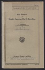
COUNTY SURVEYEDMartin County is in the northeastern part of North Carolina. (Fig. 1.) Roanoke River forms the northeastern boundary of the county. Williamston, the county seat, is about 80 miles southwest of Norfolk, Va., and about 90 miles east of Raleigh, the capital of the State. The county is irregularly oblong in shape, its extreme northwest-southeast dimension being about 42 miles and its average north and south dimension, about 12 miles. Its total area is 464 square miles, or 296,960 acres. This includes 3 square miles, now belonging to Beaufort County, but which was not included in the survey of that county made in 1917.
Figure 1.—Sketch map showing location of Martin County, North CarolinaMartin County lies almost entirely in what is known as the flatwoods section of the State, and the general relief is that of a flat plain, with undulating or gently rolling to rolling areas near the streams. The surface features vary in different sections of the county. Around Williamston and northwest of that place along the highway through Hamilton and Oak City the surface is level, gently rolling, or rolling. Some of the slopes bordering the river swamps are steep, whereas along some of the streams in the central and eastern sections of the county the slopes are gentle or moderately steep. The interstream areas range from level to undulating. The northwestern, western, southern, and southeastern sections of the county are flat. Some of the extensive flat areas are locally called pocosins, the largest of which is Great Swamp in the southeastern part of the county; another is between Hassell and Parmele. Smaller pocosinlike areas occur elsewhere. Along Conoho Creek and Roanoke River are small broken terraces that lie from 10 to 30 feet below the uplands and have a level or undulating surface. One large area of first-bottom land, adjacent to Roanoke River near the mouth of Conoho Creek, is less than 10 feet above sea level. These bottom-land areas range in width from one-eighth mile to more than 6 miles. Along Roanoke River, from the Halifax County line to 2 miles below Poplar Point Landing, the land rises abruptly from the river bottom to a height ranging from 30 to 60 feet. The slopes to the other streams are gradual and well rounded.
There are no great differences of elevation in Martin County. The highest point, which is in the northwestern part of the county, is about 95 feet above sea level. At Oak City the elevation is 84 feet;
at Robersonville, 70 feet; at Williamston, which is 1 mile from Roanoke River, 60 feet; at Hamilton, one-half mile from Roanoke River, 73 feet; and at Jamesville, on Roanoke River in the eastern part of the county, about 30 feet.
About two-thirds of the county is fairly well drained; the remainder still retains its simple constructional surface and is without development of natural drainage. Drainage, where developed, is through Roanoke River and its tributaries. The general slope of the county is eastward or southeastward. Streams and branches reach nearly every part of the county except the broad flat sections, but considerable areas are poorly drained on account of the incompleteness of stream dissection. In the poorly drained areas the smaller drainage ways are very shallow and in many places are not well defined; the larger streams have cut their channels nearly to base level, and the flow is sluggish. The width of the stream bottoms in these areas ranges from a few feet to 7 miles. The areas in which natural drainage ways have not developed include Great Swamp, the pocosin between Hassel and Parmele, smaller pocosins, and the first bottoms along Roanoke River, Conoho Creek, and other creeks. The better-drained areas are the uplands along the Roanoke River swamp, Conoho Creek swamp, Ready and Dog Branches, Sweetwater and Gardners Creeks, and in the vicinities of Oak City, Goldpoint, Everetts, Robersonville, and Dardens.
Martin County was organized on March 19, 1774, being formed from parts of Halifax and Tyrrell Counties.
The white population of Martin County is dominantly of Scotch, Scotch-Irish, and English descent. According to the 1930 census1 the total population of the county is 23,400, which includes a large number of negroes. Williamston, near the central part of the county on Roanoke River, is the county seat and largest town, having a population of 2,731 in 1930. The rural population is fairly evenly distributed over the county except in the poorly drained sections in the northwestern and southeastern parts, which are uninhabited. The most thickly populated sections are along the main highways, in the vicinities of Williamston, Hamilton, Oak City, Goldpoint, Robersonville, Everetts, Jamesville, and Dardens, all of which are important local shipping points.
Transportation facilities of Martin County are good. The Kinston and Plymouth branches of the Atlantic Coast Line Railroad cross the county, and in addition to the rail facilities the northeastern part has good water transportation. Freight boats operate on Roanoke River as far up as Hamilton. Three State highways cross the county. Highway No. 90 is hard surfaced from Williamston to Raleigh and is being paved (1928) from Williamston to Plymouth; Highway No. 30 is hard surfaced from Williamston to Washington, Beaufort County; and Highway No. 125, extending from Williamston to the Halifax County line, is a sand-clay road.
Good schools and churches are conveniently located in all sections of the county. In many places the schools have been consolidated and large brick schoolhouses built. Telephone and rural mail routes reach every section.
1 Soil survey reports are dated as of the year in which the field work was completed. Later census figures are given whenever possible.CLIMATEThe climate of Martin County is mild and healthful. The winters are comparatively mild, and the summers are long and rather hot. The mean winter temperature is 42.7° F. There are usually three or four cold periods during the winter, and the temperature has fallen as low as -2°, but such low temperatures are unusual. The mean summer temperature is 78.3°. Temperatures of 105° have been reached in both July and August, and 106° has been recorded in September.
The frost-free season in Martin County is long enough for maturing all the crops common to this region. At Tarboro, in Edgecombe County, the average date of the last killing frost is April 9 and of the first is October 27, giving an average frost-free season of 201 days. The frost-free period is probably a few days longer in Martin County. Frosts have been recorded as late as April 26 and as early as October 10.
The average annual rainfall is 49.15 inches. The total precipitation for the driest year on record (1921) was 34.03 inches and for the wettest year (1887), 80.88 inches. The rainfall is well distributed throughout the year, being heaviest in the summer and lightest in the fall. Crops are seldom damaged by droughts, but heavy rains after dry periods cause damage on the imperfectly drained soils.
Occasional snows occur, but they are light and of short duration. However, deep snows, measuring 14 inches and 28 inches, respectively, fell in January and March, 1927.
Table 1, compiled from the records of the Weather Bureau station at Tarboro, represents, approximately, weather conditions in Martin County.
| Month | Temperature | Precipitation | |||||
| Mean | Absolute maximum | Absolute minimum | Mean | Total amount for the driest year (1921) | Total amount for the wettest year (1887) | Snow, average depth | |
| ° F. | ° F. | ° F. | Inches | Inches | Inches | Inches | |
| December | 43.1 | 79 | 1 | 3.65 | 2.38 | 3.82 | 1.5 |
| January | 42.1 | 81 | -2 | 3.75 | 2.37 | 3.59 | 1.4 |
| February | 42.8 | 80 | -2 | 4.11 | 3.34 | 3.56 | 2.7 |
| Winter | 42.7 | 81 | -2 | 11.51 | 8.09 | 10.97 | 5.6 |
| March | 51.5 | 96 | 13 | 3.79 | 3.26 | 3.89 | .8 |
| April | 59.7 | 97 | 26 | 3.49 | 3.30 | 2.95 | .3 |
| May | 69.4 | 101 | 34 | 4.57 | 5.07 | 5.55 | .0 |
| Spring | 60.2 | 101 | 13 | 11.85 | 11.63 | 12.39 | 1.1 |
| June | 76.5 | 104 | 46 | 4.38 | .90 | 3.08 | .0 |
| July | 79.8 | 105 | 48 | 6.30 | 5.28 | 11.63 | .0 |
| August | 78.7 | 105 | 52 | 5.97 | 1.15 | 22.73 | .0 |
| Summer | 78.3 | 105 | 46 | 16.65 | 7.33 | 37.44 | .0 |
| September | 73.1 | 106 | 36 | 3.49 | 1.49 | 2.02 | .0 |
| October | 62.0 | 97 | 27 | 3.22 | 1.22 | 6.12 | .0 |
| November | 51.1 | 87 | 16 | 2.43 | 4.27 | 1.94 | .2 |
| Fall | 62.1 | 106 | 16 | 9.14 | 6.98 | 10.08 | .2 |
| Year | 60.8 | 106 | -2 | 49.15 | 34.03 | 70.88 | 6.9 |
AGRICULTURE
Agriculture in Martin County began more than 200 years ago. At first it consisted in the production of corn and some wheat, and in livestock raising, lumbering, and the manufacture of tar, pitch, turpentine, and staves. The fish industry was also an important source of income to early settlers. Evidence of former cultivation indicates that many areas of the poorly drained and heavy dark-colored soils were farmed before the Civil War. It seems to have been the custom in early days, before the use of commercial fertilizer, to cultivate a field until production was no longer profitable and then to abandon it and clear a new field. Some of the land had to be artificially drained, and this was done mainly by slaves. After the Civil War many of the drainage ditches were allowed to fill, and the areas reverted to forest. Most of the timber now being cut is on these old fields.
According to the United States Census, corn has always been grown on a larger acreage than any other crop. Cotton ranked second from 1879 to 1899. Peanuts were introduced between 1879 and 1889 and tobacco between 1889 and 1899. The largest recorded acreages ever devoted to corn and cotton were in 1889. In that year 26,563 acres of corn produced 174,565 bushels, or a little more than 6 bushels to the acre, and 20,275 acres planted to cotton produced 5,048 bales, or about one-fourth bale to the acre.
Table 2 gives the acreage and yields of the principal crops as given by the censuses from 1880 to 1925, inclusive.
| Crop | 1879 | 1889 | 1899 | 1909 | 1919 | 1924 | ||||||
| Acres | Bales | Acres | Bales | Acres | Bales | Acres | Bales | Acres | Bales | Acres | Bales | |
| Cotton | 13,444 | 6,383 | 20,275 | 5,048 | 8,614 | 4,496 | 11,835 | 5,777 | 11,330 | 8,184 | 18,692 | 8,620 |
| Bushels | Bushels | Bushels | Bushels | Bushels | Bushels | |||||||
| Corn | 24,209 | 227,445 | 26,563 | 174,565 | 24,943 | 265,940 | 21,002 | 235,185 | 19,151 | 420,310 | 16,946 | 307,441 |
| Peanuts | 841 | 26,801 | 7,821 | 349,945 | 16,396 | 645,317 | 12,558 | 575,920 | 17,589 | 687,958 | ||
| Oats | 1,447 | 11,229 | 3,078 | 24,308 | 1,419 | 12,510 | 864 | 9,748 | 1,027 | 23,888 | 25 | 480 |
| Wheat | 940 | 6,254 | 206 | 1,581 | 40 | 260 | 25 | 138 | 17 | 149 | ||
| Sweetpotatoes | 829 | 92,913 | 1,063 | 90,841 | 919 | 88,285 | 939 | 119,138 | 1,036 | 94,220 | 555 | 44,039 |
| Pounds | Pounds | Pounds | Pounds | Pounds | Pounds | |||||||
| Tobacco | 1 | 211 | 1,967 | 1,353,040 | 3,183 | 1,813,278 | 8,089 | 5,369,303 | 8,654 | 5,180,546 | ||
| Tons | Tons | Tons | Tons | Tons | Tons | |||||||
| Hay | 37 | 21 | 43 | 44 | 97 | 120 | 1,287 | 1,538 | 6,323 | 2,770 | 10,865 | 5,334 |
The present system of agriculture consists of the production of general and special crops. Peanuts, cotton, and tobacco are the principal cash crops, and corn, sweetpotatoes, oats, and hay are the main subsistence crops. Some sweetpotatoes are sold for cash. Potatoes, cowpeas, soybeans, wheat, and vegetables are minor crops, and apples, peaches, pears, plums, and grapes are grown in a small way.
A few beef cattle are raised, and almost every farmer has a milk cow to supply milk for home use. The 1920 census reported 3,337 cattle in the county, and of these 2,334 were beef cattle. Hogs are
raised to supply meat for the home, and the surplus is sold. The number of hogs on each farm ranges from 1 or 2 to 100 or more. The larger herds are raised by the better farmers and are fattened for shipment out of the county. The principal breeds are Duroc-Jersey, Berkshire, and Hampshire. Very few mules and horses are produced for market.
Table 3 gives the value of all agricultural products, by classes, in 1919.
| Crops | Value | Livestock and livestock products | Value |
| Cereals | $846,318 | Domestic animals | $1,203,610 |
| Other grains and seeds | 1,350,992 | Dairy products, excluding home use | 9,849 |
| Hay and forage | 99,317 | Poultry and eggs | 95,606 |
| Vegetables | 268,975 | Wool, mohair, and goat hair | 175 |
| Fruits and nuts | 17,438 | ||
| All other crops 1 | 4,599,986 | Total | 1,309,240 |
| Total agricultural products | 8,492,266 | ||
| Total | 7,183,026 | ||
| 1 Mainly cotton, peanuts, and tobacco. |
Until recently corn has been the leading crop in acreage, and it is grown on every soil in the county with varying results. The yields range from 6 or 8 bushels on the poorer soils to 50 bushels on the Dunbar, Lenoir, Bladen, and the better grades of Norfolk and Wickham soils. Practically all the corn is used on the farm for feed and a little is ground into meal for bread. Some corn is shipped into the county each year.
In 1924 peanuts were planted on 17,589 acres and produced 687,958 bushels, or an average of about 40 bushels to the acre. The principal varieties are the Virginia Bunch, Virginia Runner, and Jumbo Spanish. The peanuts are bought by local buyers and are shipped out of the State, mainly to Suffolk and Norfolk. At harvest time about one-fourth of the peanuts are left in the ground, and hogs are turned into the field to eat them. Some fields are planted to peanuts for the sole purpose of fattening hogs.
There were 18,692 acres planted to cotton in 1924, producing 8,620 bales, or an average of about one-half bale to the acre. This is more than the average for the cotton section of the State. Cotton is shipped out of the county.
Tobacco was grown on 8,654 acres in 1924, with a production of 5,180,546 pounds, or an average of a little less than 600 pounds to the acre. Tobacco is grown most extensively on soils of the Norfolk, Lenoir, Ruston, Dunbar, Onslow, and Wickham series. Most of the leaf is light and is used for cigarettes. Bonanza, Jamaica (wrapper), and Davis Special are the principal varieties. The tobacco fields range in size from a few acres to 50 or more acres. Tobacco transplanters are in general use, but much hand labor is employed in the production of this crop. All the tobacco is artificially firecured in barns, three days being required to cure a barnful of leaves.
Sweetpotatoes were planted on 555 acres in 1924 and produced 44,039 bushels, or about 80 bushels to the acre. According to the
county agricultural agent and some of the better farmers, yields on the Norfolk, Ruston, Wickham, and parts of the Lenoir and Dunbar soils range from 100 to 400 bushels to the acre. Most of the fields are small. The principal varieties of sweetpotatoes are Porto Rico and Nancy Hall. There are at present eight sweetpotato-curing houses in the county.
Oats is an unimportant crop. From all available information, none of the oat crop at present is threshed but is cut for hay or allowed to ripen and is fed in the sheaf. The crop is sown in early spring, mostly on the dark-colored soils. The production of wheat is practically negligible, having decreased steadily since 1879.
The potato crop is not important, although a few farmers grow potatoes on a commercial scale. The better farmers report yields ranging from 100 to 250 bushels to the acre. The yields are not so high when the potatoes are dug for early market. This crop is usually planted on soils having dark surface soils.
In 1924 hay, mostly legumes cut green, occupied 10,865 acres, and the production was 5,334 tons. Peanut vines are baled and used for hay by most of the farmers, and fodder and tops are saved for coarse forage. A considerable amount of hay is shipped into the county each year. The total expenditure for feed in 1924 on the 205 farms reporting was $15,633, or an average of $76.26 a farm.
Minor crops grown on nearly every farm are sorgo (sweet sorghum), garden vegetables, soybeans, cowpeas, strawberries, and rye. Lespedeza, vetch, and clover are grown to a small extent by a few farmers. There are a few fruit trees on nearly every farm. The 1924 census reported 12,061 apple trees, 9,535 peach trees, 1,553 pear trees, and 1,499 grapevines.
Most of the soils of Martin County are mellow, and only light implements are necessary to prepare a good seed bed. The better farmers use 2-horse plows, both riding and walking, and also riding cultivators. A number of tractors are in use. The tenant farmers break the land to a slight depth and use 1-horse cultivators. Very little of the land is plowed in the fall or winter. Some plowing is done in early spring, but most of the farmers break land just before planting time. The land is cultivated level for the peanut crop, and corn and cotton are planted on low ridges. The better farmers plant corn in rows 6 feet apart, with a row of soybeans between. Cotton is planted thickly in rows 3 feet apart, and after it is well up it is thinned to the proper stand.
Peanuts are dug, the vines stacked on small poles until fall or early winter, and the nuts then picked off by machinery. The peanut hay, which makes good feed for cattle, is baled at the same time. The leaves, dirt, and vines that accumulate around the picker are hauled and spread over the fields for soil-improvement purposes. Some of the soybeans are gathered with a soybean harvester, some are cut for hay, but the greater part is left in the fields as hog feed and for improving the soil. Corn is gathered in late fall. The stalks are allowed to stand until early spring and are then either cut up with stalk cutters and plowed under or are cut down, raked or picked up, and burned. On burning the stalks the organic matter needed in the soil is lost.
A few farmers use draintile, but open ditches are the general system of drainage.
Little attention is paid to systematic crop rotation. It is common practice to follow corn and soybeans with cotton, peanuts, or tobacco. Tobacco usually follows a clean-cultivated crop. Many of the fields which are to be used for tobacco are sown to rye in the fall and this is turned under in the early spring.
Commercial fertilizers are in general use by all farmers, and every crop receives heavy applications. According to the 1925 census the expenditure for fertilizer (including lime) in 1924 on the 2,712 farms reporting was $628,725, or an average of $231.83 a farm. An application ranging from 1,000 to 1,200 pounds of a 4-8-62 or 3-8-5 fertilizer is used for tobacco. Cotton receives from 500 to 800 pounds of a 4-8-4 or 4-10-3 mixture. Peanuts are commonly fertilized with a 1½-8-4 mixture, but a 2-8-4 mixture is recommended by the North Carolina Agricultural Experiment Station for this crop. From 400 to 500 pounds of a 3-8-3 fertilizer is applied to corn at planting time and from 100 to 150 pounds of nitrate of soda is added as a top-dressing when the corn is about 2 feet high, if the color of the corn at this time indicates extra nitrogen is needed by the crop.
Lime is applied to all land but more especially to the dark-colored moist soils and to the land used for peanuts, the usual application ranging from 500 to 1,000 pounds of burnt lime or ground limestone to the acre. Where the soil is very acid, dolomitic or magnesian limestone is recommended for all crops, especially for peanuts. This is applied in the spring before planting time, and from 150 to 200 pounds of land plaster is applied about blooming time.
Only a few of the country homes are large. The tenant houses are small but comfortable. The barns are generally large enough to house the work animals and to provide storage for feed and implements. Modern farm implements are used on nearly all farms. Corn, cotton, and peanut planters and tobacco transplanters and cultivators are in use by many farmers. The work animals consist chiefly of medium-sized mules. The cattle are grades, with the exception of a few purebred bulls.
Most of the labor is native born, both white and negro. The farmer's family does much of the farm labor, as hired help is scarce and rather high. Day wages range from $1.25 to $2 and in some instances $2.50 is received for stripping tobacco and working around peanut-picking machines. Monthly wages range from $30 to $50, including a house and garden.
Farms range in size from 10 to more than 1,000 acres. The average size, according to the United States census report for 1925, is about 61.8 acres, each tenancy being tabulated as a farm.
In 1925, 39.9 per cent of the farms were operated by owners, 59.8 per cent by tenants, and 0.3 per cent by managers. Most of the tenant-operated land is rented on a share basis. Where the land-owner furnishes the land, implements, half the fertilizer, and seed, he receives one-half of the crop; where the tenant furnishes everything except the land, the landlord receives one-third of the crop.
The cultivated land in the county ranges in price from $30 to $100 an acre. Cut-over, timbered, and poorly drained areas sell from $10 to $50 an acre. According to the census the average value of farm land was $46.56 an acre in 1925.
2 Percentages, respectively, of nitrogen, phosphoric acid, and potash.SOILS
Soils are classified according to their color, structure, texture, drainage conditions, and the sources of material from which they are formed. The soils which are similar in all characteristics except texture are grouped in a series named from some town, village, or county where the soils were first mapped. On the basis of texture, or the relative amount of sand, silt, and clay in the surface soil, the series are divided into soil types, the unit of soil classification.
In Martin County 14 soil series, including 21 soil types and 4 phases of types, and 2 miscellaneous classes of material, meadow and swamp, are mapped.
The soils of the Norfolk series are characterized by gray surface soils, pale-yellow subsurface soils, and yellow friable sandy clay and sand subsoils. These soils occupy the better-drained positions in the county. Norfolk fine sandy loam, with a deep phase, Norfolk loamy fine sand, and Norfolk fine sand are mapped in Martin County.
The Lenoir soils have gray or brownish-gray surface soils and dull-yellow or olive-drab heavy subsoils which are mottled with gray and light red in the lower part. The surface is level or gently rolling, and drainage is fair. The very fine sandy loam, fine sandy loam, and fine sandy loam, deep phase, of this series are mapped.
The soils of the Ruston series are characterized by grayish-yellow or grayish-brown surface soils, pale-yellow subsurface layers, and reddish-brown or yellowish-red friable subsoils. The main difference between soils of this series and those of the Norfolk is the color of the subsoil. The deep phase of Ruston fine sandy loam is the only representative of the Ruston series in Martin County.
In virgin areas the Dunbar soils have thin dark-gray surface layers underlain by pale-yellow subsurface layers and subsoils which are mottled gray, yellow, and brown and splotched with red. Dunbar fine sandy loam and Dunbar very fine sandy loam are mapped.
The soils of the Plummer series have dark-gray surface soils, light-gray subsurface soils, and gray, or gray mottled with yellow or rust brown, friable subsoils. Only one member of the Plummer series, the fine sandy loam, is mapped.
The Lufkin soils have light-gray or gray surface soils and dingy-gray or mottled gray, drab, and yellow heavy tough plastic subsoils. These soils are closely associated with the Coxville soils on one hand and the Lenoir soils on the other. Lufkin very fine sandy loam is developed in this county.
The Onslow soils are characterized by dark surface layers and coffee-colored hardpan layers overlying light yellowish-gray subsurface layers, yellowish-drab upper subsoil layers, and mottled gray, yellow, and drab heavy clay lower subsoil layers. Onslow very fine sandy loam is mapped.
The soils of the Coxville series have gray or dark-gray surface soils and gray, mottled with yellow, heavy tough or plastic clay subsoils. The lower part of the subsoil is in most places splotched with bright red and is more plastic than the upper part. These soils are developed in the “savanna land,” or the seaward part of the Atlantic coastal plain. In this county Coxville very fine sandy loam and Coxville silt loam are mapped.
The Portsmouth soils are characterized by dark-gray or black surface soils and gray, mottled with yellow or brown, friable sandy clay subsoils. These soils have developed under semiswampy and forested conditions. The surface material has been formed by the decomposition of leaves and other vegetable matter. Portsmouth fine sandy loam, with its better-drained phase, and Portsmouth loam are mapped in Martin County.
The Bladen soils have gray, grayish-brown, or almost black surface soils and gray and drab, mottled with brownish yellow or ocherous yellow, tough plastic impervious subsoils. These soils, which are developed in the eastern part of the coastal plain, are closely associated with the Coxville soils. Bladen very fine sandy loam and Bladen loam are developed in the county.
The Kalmia soils have gray or yellowish-gray surface soils and yellow friable subsoils. These soils are developed on the second bottoms of some of the coastal-plain streams. Only one type, Kalmia loamy fine sand, is mapped.
The soils of the Wickham series have grayish-brown or brown surface soils and reddish-brown or brownish-red subsoils. These are second-bottom soils and represent materials brought down from the piedmont plateau and deposited by Roanoke River when it flowed at higher levels. Wickham fine sandy loam and Wickham sand are mapped.
The soils of the Roanoke series have gray surface soils and gray, mottled with yellow and brown, heavy tough clay subsoils. These soils occupy second bottoms along streams flowing out of the piedmont section. Only one type, Roanoke silt loam, occurs in this county.
The Congaree soils have brown surface soils and brown or yellowish-brown subsoils. These soils are developed in the first bottoms along Roanoke River, where they represent recent soil material brought down from the piedmont section and redeposited along the river. Congaree silty clay loam is mapped.
The soils of Martin County are described in detail in the following pages and their agricultural utility is discussed. The map accompanying this report shows the distribution of the soils, and Table 4 gives their acreage and proportionate extent.
| Type of soil | Acres | Per cent | Type of soil | Acres | Per cent |
| Norfolk fine sandy loam | 51,584 | 18.8 | Coxville silt loam | 5,376 | 1.8 |
| Deep phase | 4,032 | 18.8 | Portsmouth fine sandy loam | 7,552 | 2.6 |
| Norfolk loamy fine sand | 5,056 | 1.7 | Better-drained phase | 448 | 2.6 |
| Norfolk fine sand | 1,472 | .5 | Portsmouth loam | 5,824 | 2.0 |
| Lenoir very fine sandy loam | 22,528 | 7.6 | Bladen very fine sandy loam | 9,664 | 3.3 |
| Lenoir fine sandy loam | 10,752 | 4.5 | Bladen loam | 5,120 | 1.7 |
| Deep phase | 2,752 | 4.5 | Kalmia loamy fine sand | 1,280 | .4 |
| Ruston fine sandy loam, deep phase | 832 | .3 | Wickham fine sandy loam | 1,792 | .6 |
| Dunbar fine sandy loam | 27,008 | 9.1 | Wickham sand | 768 | .3 |
| Dunbar very fine sandy loam | 10,240 | 3.4 | Roanoke silt loam | 640 | .2 |
| Plummer fine sandy loam | 24,704 | 8.3 | Congaree silty clay loam | 640 | .2 |
| Lufkin very fine sandy loam | 1,408 | .5 | Meadow | 4,096 | 1.4 |
| Onslow very fine sandy loam | 2,624 | .9 | Swamp | 53,760 | 18.1 |
| Coxville very fine sandy loam | 35,008 | 11.8 | |||
| Total | 296,960 |
NORFOLK FINE SANDY LOAM
To a depth ranging from 3 to 5 inches, Norfolk fine sandy loam in wooded areas is gray or dark-gray loamy fine sand, containing a small quantity of organic matter. This passes into a layer of pale-yellow or grayish-yellow fine sandy loam or loamy fine sand which extends to a depth ranging from 15 to 18 inches. The subsoil, or heavier layer, is yellow friable fine sandy clay which continues to a depth ranging from 25 to 35 inches and is underlain by mottled gray, yellow, and red fine sandy clay. In cultivated fields the surface soil is gray or brownish gray to the depth of cultivation. In some of the level areas where this soil joins the Dunbar, Lenoir, or Coxville soils the subsoil is heavier than typical and is slightly mottled with gray, yellow, and red at a depth ranging from 24 to 30 inches. On some of the slopes the yellow sandy clay subsoil layer is exposed, and in small spots the soil is eroded as far down as the parent material. Included with Norfolk fine sandy loam in mapping are small areas of Norfolk loamy fine sand, Norfolk fine sand, Lenoir fine sandy loam, and Dunbar fine sandy loam.
Norfolk fine sandy loam occurs in the higher and better-drained sections in the central and northwestern parts of the county. The largest areas lie north and south of Ready Branch, on the east and west sides of Beaverdam Creek, and in the vicinities of Hamilton and Oak City. Numerous smaller bodies are near the drainage ways in the northwestern two-thirds of the county. Only one or two small bodies occur in the southeastern third of the county.
This soil has a gently rolling, level, or undulating surface. Natural drainage for the most part is good, but some of the more level areas need artificial drainage.
This is the most extensive and most important agricultural soil in the county, about 70 per cent of it being cleared and farmed. The remainder supports a tree growth consisting principally of loblolly pine, with a few white oak, sweetgum, dogwood, black gum, red cedar, holly, longleaf pine, and hickory. Parts of the now wooded areas were once cultivated fields.
Norfolk fine sandy loam is used chiefly for the production of peanuts, cotton, tobacco, corn, and sweetpotatoes. The first three are cash crops, and the corn is grown for feeding work animals or, to a small extent, for grinding into meal for home consumption. Potatoes, melons, and other vegetables are minor crops used mostly at home. Rye, soybeans, and peas are grown for feed and as soil-improvement crops.
Tobacco yields from 700 to 1,200 pounds to the acre, peanuts from 45 to 80 bushels, cotton from one-half to 1 bale, sweetpotatoes from 100 to 400 bushels, and peanut hay 1½ tons. Garden vegetables do well on this soil.
Commercial fertilizer is in general use for all crops. When peanuts are planted after a heavily fertilized crop, only small amounts of fertilizer are used and from 500 to 1,000 pounds of ground limestone or magnesian (dolomite) lime is applied to the land in the spring before the seed is planted. Land plaster is applied at the time the blossoms come on the vines. A 1½-8-4 or a 2-10-5 mixture of fertilizer is generally used. The North Carolina Agricultural Experiment Station recommends a 2-8-4 mixture. From 400
to 800 pounds of a 4-8-4 or 4-10-4 fertilizer is usually applied to cotton land at planting time. Tobacco receives an application ranging from 1,000 to 1,200 pounds of a 4-8-6 or 3-8-3 mixture. Corn is fertilized with about 500 pounds of a 3-8-3 mixture at planting time and with a top-dressing ranging from 100 to 150 pounds of nitrate of soda when the corn is about 2 feet high. Rye, soybeans, and cowpeas are sown for soil improvers and are rarely fertilized.
This is a well-drained, mellow, and easily cultivated soil, but it contains a very small proportion of organic matter. This can be supplied by growing and turning under legumes such as soybeans, cowpeas, crimson clover, vetch, and rye. Norfolk fine sandy loam is well suited to bright-leaf tobacco, cotton, sweetpotatoes, peanuts, potatoes, melons, and truck crops.
Norfolk fine sandy loam, deep phase.—The surface soil of the deep phase of Norfolk fine sandy loam consists of gray loamy fine sand to a depth of 6 or 8 inches, passing into pale-yellow loamy fine sand or fine sand which continues to a depth ranging from 20 to 32 inches. Below this sandy layer is yellow friable fine sandy clay which continues to a depth of 40 or more inches. This soil differs from the typical soil mainly in the depth at which the yellow fine sandy clay subsoil occurs. Soil of the deep phase generally contains more fine sand than the typical soil, and the surface soil in cultivated fields is lighter in color. The substratum, or the material underlying the subsoil, is about the same as that under the typical soil. In the deep phase are included small spots of Norfolk fine sand.
The total area of the deep phase of Norfolk fine sandy loam is 6.3 square miles. The more important bodies are north of Lilly Hall School, southeast and east of Biggs School, northwest of Beargrass, south of Everetts, southeast and southwest of Burras School, in the vicinity of Goldpoint, west and north of Hamilton, and north of Hassell. A few smaller bodies occur elsewhere in the county.
Areas of this deep soil have level, gently rolling, or rolling surfaces, and the land is naturally well drained. It is used for the same crops as the typical soil and methods of handling, fertilization, and improvement are about the same, but crop yields are slightly lower.
NORFOLK LOAMY FINE SANDA very thin layer of leaf mold covers the surface soil of Norfolk loamy fine sand in forested areas. The soil beneath is gray or dark-gray loamy fine sand which extends to a depth ranging from 5 to 7 inches. It is underlain by pale-yellow fine sand which passes, at a depth ranging from 28 to 32 inches, into yellow friable sandy clay. The underlying material below a depth ranging from 42 to 50 inches is lighter in texture. In places the subsoil is mottled with gray, and in other places a thin layer of feebly cemented material, which is faint brown in wooded areas and light gray or grayish yellow in cultivated fields, appears just below the surface soil.
Included in mapped areas of this soil are small spots of Norfolk fine sandy loam, Norfolk fine sandy loam, deep phase, Norfolk fine sand, and Ruston fine sandy loam, deep phase.
Areas of Norfolk loamy fine sand are scattered over the central part of the county, occupying comparatively high interstream positions. The largest areas are in the vicinities of Williamston, Everetts,
and Goldpoint, south of Sandy Ridge School, and north of Hamilton. The surface of this soil is level, gently rolling, or rolling, and owing to the porosity of the soil material, natural drainage is good.
About 80 per cent of the land is cultivated, and the remainder supports a forest growth consisting mainly of old-field pine. Judging from the remaining stumps the virgin growth was mainly long-leaf pine.
Peanuts, tobacco, cotton, and corn are the principal crops, and sweetpotatoes, potatoes, cowpeas, and vegetables are minor crops which do well on this soil. Crop yields are only slightly less than on Norfolk fine sandy loam. Although the yield of tobacco is not quite so high as on the fine sandy loam, the leaf is brighter and brings a higher price.
This soil is deficient in organic matter, and fertilization and methods of improvement are the same as for Norfolk fine sandy loam. Land values of the two soils are the same.
NORFOLK FINE SANDIn forested areas the surface soil of Norfolk fine sand, to a depth ranging from 1 to 3 inches, is dark-gray loamy fine sand, the dark color being caused by organic matter. In cultivated areas the surface soil is lighter in color. Under this layer is pale-yellow and grayish-yellow fine sand, grading at a depth of 6 or 8 inches into yellow or pale-yellow loose incoherent fine sand which continues to a depth ranging from 38 inches to several feet. In places loamy fine sand or friable fine sandy clay is reached at a depth of 28 or 30 inches. The substratum, or underlying material, may be yellow or brown friable fine sandy clay or pale-yellow fine sand. Spots of Norfolk loamy fine sand and of the deep phase of Norfolk fine sandy loam are included with this soil in mapping.
Norfolk fine sand is inextensive. Areas occur in the vicinities of Williamston and Poplar Point Church, northeast and southeast of Biggs School, east of Woolard School, and south of Burras School. The small area southeast of Biggs School is of medium texture.
The surface is level or gently rolling, and owing to its fine sandy texture and loose consistence this soil is well or excessively drained.
Norfolk fine sand is not a strong soil, but most of it is under cultivation, principally to tobacco, peanuts, and truck crops. Some cotton, corn, sweetpotatoes, and potatoes are grown with fair results. The tree growth on the remainder consists mainly of old-field pine and a few black oaks.
Crop yields on this soil vary considerably. Some farmers who grow legumes and cover crops for turning under and who make heavy applications of commercial fertilizer obtain yields that compare favorably with those obtained on Norfolk fine sandy loam. Where large quantities of organic matter have been added to the soil and proper fertilization is practiced the yields of cotton and corn are high enough to make their production profitable.
This soil is very easy to cultivate and only light implements need be used. The same kinds of fertilizers as those used on Norfolk fine sandy loam are applied to this soil.
Norfolk fine sand contains very little organic matter and dries out quickly. The organic matter can best be supplied by growing and turning under green-manure crops, which will also help the soil retain the fertilizer which has been applied. Heavy applications of stable manure are very beneficial.
LENOIR VERY FINE SANDY LOAMThe 1 or 2 inch surface layer of Lenoir very fine sandy loam in forested areas is dark-gray or nearly black very fine sandy loam mixed with organic matter. Below this is a layer of pale-yellow or grayish-yellow very fine sandy loam from 5 to 7 inches thick. In cultivated fields the surface soil is gray or brownish gray to the depth of plowing. The subsoil to a depth ranging from 22 to 26 inches is dull yellowish-brown or olive-drab heavy stiff silty clay which breaks into angular blocks having a rather smooth surface along cleavage lines and the same color as across breakage particles. When crushed the subsoil material is brownish yellow. Below this is a transitional layer of yellow, mottled with gray and brown, heavy clay containing very thin layers of very fine sand. The subsoil in most places reaches a depth of 30 inches, where it passes rather abruptly into a 10 or 12 inch steel-gray heavy plastic layer mottled with brownish yellow. The underlying material, between depths of 40 and 60 inches, is light-gray, mottled with yellow and brown, friable very fine sandy clay. In places the surface soil is shallow and the brown or dull-yellow heavy subsoil is exposed giving the soil a yellowish-brown appearance. In places some red mottling occurs in the lower part of the subsoil. Small areas of Lenoir fine sandy loam, Lufkin very fine sandy loam, Onslow very fine sandy loam, and Norfolk fine sandy loam are included with this soil as mapped.
The largest development of Lenoir very fine sandy loam is in the eastern part of the county. The largest body extends along the Atlantic Coast Line Railroad from Cooper School through Jamesville and Dardens. Smaller areas are scattered over different parts of the county, some of which occur in the vicinity of Roberson Store, south and east of Asa Manning School, south of Free Union Church, east of Bethlehem Church, southeast and northwest of Williamston, south of Robersonville, east of Lilly Hall School, and east of Ballard.
This soil for the most part occupies broad flat interstream positions, and the relief ranges from level to gently sloping. Natural drainage is fair or good. The heavy subsoil renders internal drainage inadequate and in places the soil should be artificially drained for the best results.
About 80 per cent of the Lenoir very fine sandy loam is farmed; the tree growth on the remainder consists principally of loblolly pine, post oak, white oak, and sweetgum. The main crops grown are peanuts, corn, cotton, and tobacco. Soybeans, cowpeas, rye, and oats are grown by some farmers. Sweetpotatoes, potatoes, and other vegetables are minor crops grown mostly for home use.
Peanuts yield from 45 to 85 bushels to the acre and from 1 to 1½ tons of hay, corn yields from 30 to 50 bushels, and tobacco from 800 to 1,400 pounds.
Peanut land is usually limed with ground limestone or dolomitic lime, the rate of application ranging from 500 to 1,000 pounds to the acre. From 300 to 400 pounds of a 1½-8-4 fertilizer to the acre is also applied. A 2-8-4 grade is recommended by the North Carolina Agricultural Experiment Station. Cotton receives from 500 to 800 pounds of a 4-8-4 or 4-10-4 fertilizer, corn receives from 400 to 500 pounds of a 3-8-3 mixture at planting time and from 100 to 150 pounds of nitrate of soda as a top-dressing, and tobacco land receives from 1,000 to 2,000 pounds of a 4-8-6, 4-8-5, or 5-8-5 mixture.
Lenoir very fine sandy loam is deficient in organic matter. This can be supplied by turning under soybeans, cowpeas, rye, and vetch, which will improve the texture of the soil as well as add the necessary humus to the land.
LENOIR FINE SANDY LOAMThe surface soil of Lenoir fine sandy loam consists of gray or brownish-gray loamy fine sand to a depth of 6 or 8 inches. The subsoil begins as dull-yellow or drab heavy clay, passing quickly into mottled brown, yellow, gray, and red material which is generally plastic and breaks into angular fragments. In many places a subsurface layer of pale-yellow fine sandy loam occurs, and in other places the subsoil is red mottled with yellow, gray, and purple. The surface soil in some areas may be eroded, leaving the subsoil exposed.
This soil occurs in narrow strips on the slopes bordering the streams. The surface is gently rolling or rolling, and the run-off is excessive.
Areas of Lenoir fine sandy loam occur along Roanoke River and the Roanoke River swamp, on both sides of Conoho Creek, on the slopes of Sweetwater Creek and its branches, and along Tranters, Smithwick, and Long Creeks.
Owing to the general surface features of this soil it is little used for agriculture. If farmed it would erode badly. Most of it is in forest, chiefly of pine, oak, hickory, dogwood, cedar, sourwood, and maple.
Crops, yields, and methods of fertilization are similar to those on the deep phase of Lenoir fine sandy loam.
Lenoir fine sandy loam, deep phase.—Lenoir fine sandy loam, deep phase, in wooded areas has a 1 or 2 inch surface layer of dark-gray fine sandy loam which pasess into gray or grayish-yellow fine sandy loam. At a depth of 6 or 8 inches this material grades into pale-yellow friable fine sandy loam which extends to a depth ranging from 15 to 20 inches. The subsoil is dull-yellow or olive-drab heavy tough clay of coarse granular structure, breaking into angular particles which range in size from that of a garden pea to one-half inch in diameter. The color along breakage lines is the same as that of the soil when crushed or broken across lines. At a depth ranging from 26 to 30 inches lighter-drab, mottled with yellowish brown and gray, heavy clay having the same structure as the layer above occurs. This passes at a depth ranging from 33 to 40 inches into steel-gray, streaked with rust brown, sticky fine sandy clay which continues beyond a depth of 60 inches. The depth to the heavy layer, or subsoil, varies considerably. Small spots of Norfolk
fine sandy loam and Lenoir fine sandy loam are included with mapped areas of this phase.
The deep phase of Lenoir fine sandy loam occurs in the vicinity of Ballard, east of Poplar Point Church, and in the northwestern part of the county along Roanoke River.
This deep soil occupies only a small total acreage, but it is an important agricultural soil. It resembles Norfolk fine sandy loam, differing only in the dull color, heavy texture, and coarse structure of the subsoil. It is adapted to all the crops that are commonly grown on Norfolk fine sandy loam and is handled and fertilized like that soil. Yields are probably slightly higher on the Lenoir soil. Most of the land is in cultivation, and the remainder supports a tree growth consisting principally of white oak and loblolly pine, with a few red cedar and sweetgum.
This soil is deficient in organic matter which could be supplied by growing and turning under soybeans, rye, clovers, and peas. This practice not only puts more humus and nitrogen in the soil but improves the texture and structure.
RUSTON FINE SANDY LOAM, DEEP PHASEThe surface soil of Ruston fine sandy loam, deep phase, in cultivated areas consists of 6 or 8 inches of grayish-brown loamy fine sand passing abruptly into pale-yellow rather loose loamy fine sand which extends to a depth ranging from 24 to 30 inches. The subsoil is reddish-brown or yellowish-red friable fine sandy clay to a depth of 38 or 40 inches. The underlying substratum is yellow loose fine sandy material to a depth ranging from about 48 to 60 inches.
Included with this soil are small areas in which the depth to the sandy clay subsoil is 40 or more inches. These areas would have been mapped as Norfolk fine sand had they been larger.
The deep phase of Ruston fine sandy loam occupies only a small total acreage. It occurs on breaks following the streams. Only a few small areas are mapped east of Dardens and near Williamston. The surface is gently rolling or rolling, and both surface and internal drainage are good or excessive.
Owing to its small extent, this soil is not important. About 60 per cent of the land is cleared, and the remainder supports a forest growth of old-field pine, oak, dogwood, and a few gums. The principal crops are tobacco, peanuts, and cotton. Corn, soybeans, cowpeas, rye, and vegetables are grown to some extent.
The yields of crops, methods of handling, fertilizer treatments, and methods of improving the soil are the same as on Norfolk loamy fine sand.
DUNBAR FINE SANDY LOAMThe surface layer of Dunbar fine sandy loam in wooded areas consists of dark-gray fine sandy loam to a depth ranging from 3 to 5 inches, the dark color being due to large amounts of organic matter. In well-drained cultivated fields the surface layer is gray, but in flat poorly drained spots it is medium dark gray. Underlying the dark layer is pale-yellow or grayish-yellow fine sandy loam extending to a depth of 14 or 16 inches. The subsoil begins as yellow heavy fine sandy clay, but grades quickly into mottled gray, yellow, and red
tough sticky fine sandy clay which extends to a depth of 28 or 30 inches. The stratum below this is brownish-red and yellow, streaked with gray, hard crumbly fine sandy clay. Where this soil is associated with the Coxville soils the lower subsoil layer is plastic clay. In the area 2 miles north of Goldpointand one three-fourths mile west of Woolard School the subsoil is mottled yellow, gray, and brownish-red friable fine sandy clay or almost loamy fine sand. In places the red mottling is absent from the subsoil.
Dunbar fine sandy loam occurs in rather large bodies throughout the northwestern two-thirds of the county and is one of the more extensive soils mapped. In many characteristics, especially in surfact features and drainage, it is intermediate between the Norfolk and Coxville soils.
In general the surface of this soil is level or undulating, but in some places where the soil occurs near streams it is gently rolling. Back from the streams where it borders the more poorly drained Coxville and Plummer soils it is nearly level. Surface drainage is fair, but underdrainage is poor, and nearly all the land has to be artificially drained before it can be successfully farmed. Open ditches are in use, but tile drainage would be better.
Dunbar fine sandy loam is an important agricultural soil. Probably 75 per cent of it is cleared and cultivated. The forest growth on the uncultivated areas consists principally of old-field pine, small white oak and post oak, sweetgum, and an occasional longleaf pine, with the underbrush consisting mainly of myrtle. Corn, cotton, peanuts, and tobacco are the important crops, and soybeans and oats are grown for hay and as soil improvers. Sweetpotatoes, potatoes, and other vegetables are grown for home use.
Peanuts yield from 40 to 80 bushels to the acre, averaging about 50 bushels, and the hay averages 1½ tons. Cotton yields from one-half to 1 bale, averaging three-fourths bale; corn produces from 20 to 45 bushels, averaging about 30 bushels; and tobacco yields from 800 to 1,400 pounds, averaging 1,000 pounds to the acre.
From 500 to 1,000 pounds of lime to the acre are applied to the peanut land before breaking, and land plaster is applied later at the rate of 150 or 200 pounds. A light application of a 1½-8-4 fertilizer mixture is applied at planting time. Corn is given from 300 to 500 pounds of a 3-8-3 fertilizer to the acre and a top-dressing ranging from about 100 to 150 pounds of nitrate of soda. From 1,000 to 1,200 pounds of a 3-8-5 or 4-8-6 fertilizer is applied to tobacco land. For cotton from 400 to 800 pounds of a 4-8-4 or 4-10-4 fertilizer is applied at planting time.
Many farmers plant a row of soybeans between the corn rows, and some fields are planted to soybeans alone. Some Japan clover (Lespedeza) and cowpeas are used as soil improvers. Occasionally a crop of crimson clover is turned under, after which the land is planted to cotton, thereby increasing the yield of cotton considerably. The flatter areas of this soil, which are hard to drain, should be protected and allowed to remain in forest, the timber being included as one of the crops in the system of agriculture.
Where this soil is drained by open ditches, they should be made deeper. The soil should receive more lime, deeper plowing would prove beneficial, and a systematic crop rotation with clover or some other legume as one of the crops should be practiced. A cover
crop of rye, Japan clover, or crimson clover would fit in with the present cropping system.
DUNBAR VERY FINE SANDY LOAMDunbar very fine sandy loam in cultivated fields has a surface soil, from 5 to 7 inches thick, of gray or light-gray very fine sandy loam. In forested areas the surface layer is dark gray to a depth of 3 or 4 inches, and the subsurface layer is pale-yellow or yellowish-gray very fine sandy loam to a depth ranging from 10 to 18 inches. The subsoil is yellow heavy slightly plastic very fine sandy clay mottled with gray and brown to a depth of 25 inches. Below this depth it is generally heavy fine sandy clay mottled with gray and red. In places the subsoil is friable very fine sandy clay and the red mottling is absent. Where this soil is associated with the Coxville soils, the subsoil is heavier and the gray mottling is more pronounced. The surface soil is silty in areas associated with Coxville silt loam. Small areas of Coxville very fine sandy loam, Plummer fine sandy loam, Dunbar fine sandy loam, and Onslow very fine sandy loam are included with this soil in mapping.
Dunbar very fine sandy loam occurs as small or medium sized bodies in nearly all parts of the county. The largest areas are 2 miles west of Hurst School and in the northwestern part of the county. Some of the smaller areas occur south of Jamesville, in the vicinity of Asa Manning School immediately north of Roberson Store, north and south of Fairview Church, south of Crossroads School, southwest of Beargrass, near Smith School, in the vicinity of Sweet Home Church, and north of GoldpointNorfolk.
This soil has a level, undulating, or gently rolling surface. The gently rolling areas are nearer the stream courses, and the level areas are back from the streams and border the more poorly drained Coxville and Plummer soils. The internal drainage of Dunbar very fine sandy loam is naturally poor owing to the nearly level surface and the heavy character of the subsoil. Open ditches or tile drainage are necessary before the land can be farmed satisfactorily.
This soil is used for general agriculture, probably 50 per cent of it being cultivated. The remainder supports a forest growth consisting chiefly of old-field pine, small white oak, sweetgum, and black gum, together with a few holly, and the undergrowth is myrtle and other shrubs. The most important crops grown are cotton, corn, peanuts, and tobacco. Soybeans, rye, oats, and vegetables are grown to some extent. Some farmers sow crimson clover as a winter cover crop, which also furnishes some pasture and is later plowed under in preparation for cotton.
Cotton yields from one-third to 1 bale to the acre, averaging about three-fourths bale. Corn yields from 15 to 45 bushels, peanuts from 35 to 65 bushels, tobacco from 700 to 1,200 pounds, and soybeans from 15 to 25 bushels. Rye and oats are usually cut green for hay, but many farmers plow the rye under. Oats are usually sown on the more poorly drained areas where the surface soil is darker than typical.
All crops are fertilized except oats and rye, which usually follow a fertilized crop. The same kinds and amounts of fertilizer are used as for Dunbar fine sandy loam.
PLUMMER FINE SANDY LOAM
The surface soil of Plummer fine sandy loam in wooded or virgin areas as a rule consists of a 2 to 4 inch layer of very dark-gray fine sandy loam underlain by light-gray or ash-gray fine sandy loam or loamy fine sand extending to a depth ranging from 10 to 15 inches. The dark color of the upper part is due to the accumulation of organic matter. The subsoil to a depth ranging from 32 to 40 inches is light-gray, slightly mottled with yellow, friable fine sandy clay which is saturated with water most of the time. In some of the depressions or flatter areas the surface soil is nearly black and extends to a depth of 4 or 5 inches. If these areas could have been separated they would have been mapped as the dark surface soil phase of Plummer fine sandy loam. In other places the subsoil has more yellow mottling and is heavier than typical. A few areas of Plummer loamy fine sand, Coxville very fine sandy loam, and Dunbar fine sandy loam are included with this soil as mapped.
Plummer fine sandy loam is one of the more extensive soils in the county and is distributed throughout the central, western, and northwestern parts. It is developed principally on level areas back from the heads of drainage ways and also adjacent to the heads of small streams. In some of the rolling areas it occurs near the bases of the slopes.
Natural drainage of this soil is everywhere poor. Even on the more sloping areas surface water from the higher-lying soils seeps into the Plummer fine sandy loam and causes it to remain wet during the greater part of the year. The soil is considered difficult to drain and very little attempt has been made to drain it.
Plummer fine sandy loam is unimportant agriculturally. Only a few small areas have been reclaimed for agriculture, and these generally occur where this soil adjoins some better-drained soils. Most of the land is in forest consisting principally of loblolly pine and gum, together with a thick growth of underbrush. Some of the areas support a heavy growth of merchantable pine timber, and some of the cut-over areas are used for pasture. Where this soil is cultivated fair yields of potatoes, corn, cotton, oats, and soybeans are obtained. The cultivated areas are usually farmed in conjunction with the Norfolk and Dunbar soils. Where small patches of this soil occur on a farm they are usually planted to potatoes and the more poorly drained parts to oats. The same methods of handling the soil and the same kinds and amounts of fertilizer are used on this soil as on the Norfolk and Dunbar.
Land of this kind should remain in forest, for which it is best suited. Land values depend chiefly on the quality and quantity of the standing timber.
LUFKIN VERY FINE SANDY LOAMLufkin very fine sandy loam, locally called “white oak land,” is gray or light-gray heavy rather compact very fine sandy loam to a depth ranging from 5 to 8 inches. This passes abruptly into gray or drab-gray, mottled with yellowish brown, heavy tough clay which extends to a depth ranging from 12 to 16 inches. This material breaks into coarse angular blocks which are gray on the outside
but in a cross section or when crushed show streaks and mottlings of yellow and brown and in many places specks of red. Below this layer to a depth ranging from 50 to 60 inches is steel-gray plastic clay slightly mottled with yellow and brown. This layer has a columnar structure and breaks into angular blocks which are steel gray on the outside and many of them gray over the cross section. When the subsoil material is bored out with an auger it shows slight mottlings of yellow and brown and occasional red specks. In some of the areas occurring on slopes adjoining Lenoir very fine sandy loam, this soil resembles the Lenoir soil with the upper part of the subsoil removed.
Lufkin very fine sandy loam occupies a small acreage in Martin County. It occurs on both sides of Lanier Swamp, southwest and east of Jamesville, and near Cooper School.
The surface is level or sloping. Surface drainage is sufficient but internal drainage is poor.
Lufkin very fine sandy loam is unimportant for agriculture, and only small spots have been cleared. The soil is hard to handle as it clods when wet and bakes when dry, and crop yields are low. The principal crops are peanuts, cotton, and corn.
Peanuts yield from 20 to 50 bushels to the acre, cotton from one-fourth to one-half bale, and corn from 15 to 35 bushels. Grasses and soybeans do very well. The same kind and amounts of fertilizer are applied on this soil as on Lenoir very fine sandy loam.
ONSLOW VERY FINE SANDY LOAMThe surface soil of Onslow very fine sandy loam is wooded areas consists of about a 1-inch layer of leaf mold over dark-gray very fine sandy loam from 4 to 7 inches deep. This is underlain by a coffee-colored or brown compact or hardpan layer, from 2 to 4 inches in thickness, consisting of sand cemented with organic matter or iron salts. This layer in turn is underlain by pale-yellow or light yellowish-gray friable very fine sandy loam which extends to a depth ranging from 10 to 16 inches. The upper subsoil layer, or layer of clay concentration, is dull-drab or yellowish-drab clay which is sticky when wet and fairly friable when moist. At a depth ranging from 23 to 28 inches this material grades into mottled gray, yellow, and drab heavy clay which breaks into irregular particles ranging in size from one-eighth to one-half inch in diameter. The color along breakage lines in most places is gray, but it is mottled on cut or broken surfaces or when the particles are crushed. This layer extends to a depth of 45 or 50 inches, the gray color becoming more pronounced with depth. In cultivated fields in many places the brown indurated layer has been turned up and broken with the plow and has become mixed with the surface soil, resulting in a mottled brown and dark-gray surface soil. In places where the soil has been in cultivation for a long time the brown color is absent. Many areas which include Dunbar and Lenoir soils have probably contained the hardpan layer at one time but it has been mixed with the surface soil through cultivation and has lost its identity. Where this soil occurs in association with the Lenoir and Bladen soils the subsoil is heavier and has more gray in the lower part of the subsoil than where it is associated
with the Norfolk and Dunbar soils. A few small yellowish-brown concretions occur on the cultivated fields.
Onslow very fine sandy loam is inextensive, being developed chiefly in the eastern part of the county. It occurs between Jamesville and Dardens, south of Jamesville, near Ange School, north of Griffin School, southwest of Asa Manning School, southwest of Bethlehem Church, and southeast of Jones Chapel in the northwestern part of the county.
The surface is level or gently undulating, and natural drainage is fair. About 50 per cent of the land is cultivated. The principal crops are corn, peanuts, and cotton, and some tobacco, soybeans, and oats are produced. Crop yields are about the same as on Dunbar very fine sandy loam, and the soil is handled and fertilized in the same manner as the Dunbar soils.
COXVILLE VERY FINE SANDY LOAMThe surface soil of Coxville very fine sandy loam in wooded areas consists of a surface layer, from 3 to 5 inches thick, of dark-gray very fine sandy loam, underlain by light-gray, slightly mottled with yellow, heavy very fine sandy loam extending to a depth of 8 or 10 inches. The upper subsoil layer to a depth ranging from 20 to 28 inches is steel-gray, mottled with yellow, heavy tough slightly plastic clay. When this material is dug out it breaks into coarse blocks ranging in size from one-half inch to 2 or more inches in diameter. The particles are steel gray on the outside, and the yellow mottling does not show until the particles are crushed or broken by force across the lines of natural breakage. This layer is underlain to a depth of 48 or more inches by material which is somewhat similar but more plastic and splotched with bright red. In places the red mottling is absent from the subsoil, and in other places the surface soil is nearly black and the subsoil mottled gray and yellow sticky very fine sandy clay. These areas would have been mapped as Portsmouth soil if they had been larger. In cultivated fields the dark-gray surface soil has been mixed with the light-gray subsurface soil and is gray or light gray in color. Small areas of Bladen very fine sandy loam, Plummer fine sandy loam, and Coxville silt loam are included with this soil as mapped.
Coxville very fine sandy loam is one of the more extensive soils in the county, having large developments in the western and southern parts. It occurs mainly as flat poorly drained areas, few of which border drainage ways. Some of the large tracts are included with what is locally known as pocosin. The heavy surface soil and impervious subsoil prevent the downward percolation of water, and in rainy spells the soil in places becomes water-logged. Artificial drainage is necessary in the preparation of this soil for farming purposes. The soil is very acid.
Coxville very fine sandy loam is not an important agricultural soil. Only a very small proportion of it is in cultivation, and most of the cultivated areas occur as parts of fields which include better-drained soils. The uncultivated areas are forested chiefly with loblolly pine, together with some sweetgum and black gum, and in places a few scattered longleaf pines. Some cattle, goats, and hogs are grazed on the undergrowth which is mainly gall-berry bushes and broom sedge,
Broom sedge, especially, is abundant in cut-over forests and old fields. Briers are also common on this soil.
Corn, soybeans, and cotton are the principal crops. Corn yields from 8 to 20 bushels to the acre, cotton from one-fourth to one-half bale, and soybeans from 15 to 25 bushels. The same kinds and amounts of fertilizers are used for these crops on this soil as on the Dunbar and Lenoir soils.
Coxville very fine sandy loam commands from $20 to $50 an acre. The forested areas are valued principally for the quality of the standing timber.
Drainage is absolutely essential before this soil can be cultivated. By draining, by heavy liming, by turning under cover crops, and by proper fertilization more of the land could be farmed with profitable results.
COXVILLE SILT LOAMIn forested areas Coxville silt loam, to a depth of 3 or 4 inches, is dark-gray or nearly black silt loam. It is underlain by light-gray silt loam which continues to a depth of 6 or 8 inches. In cultivated fields the surface and subsurface layers become mixed, giving the surface soil a gray color which under long cultivation becomes light gray. The subsoil to a depth ranging from 26 to 30 inches is mottled gray and yellow heavy tough slightly plastic silty clay or clay which becomes heavier and more plastic below a depth of 26 inches, being generally plastic clay mottled with gray and yellow and splotched with bright red. In places the red is absent from the subsoil. Small areas of Bladen very fine sandy loam, Bladen loam, Portsmouth loam, and Dunbar very fine sandy loam are mapped with this soil.
The total area of Coxville silt loam in Martin County is 8.4 square miles. It occurs in flat areas in the southern part of the county.
Very little of the Coxville silt loam is under cultivation but is utilized principally for grazing and lumbering. The tree growth is similar to that on Coxville very fine sandy loam. Natural drainage is poor and all the land requires artificial drainage before it can be farmed. In the early days some of this soil was drained and farmed, but the fields were later abandoned, the ditches have filled in, and a growth of old-field pines has been allowed to develop. Some of the trees are large enough for merchantable timber. Some of this soil could be reclaimed by clearing and by opening up the ditches.
Coxville silt loam is handled and fertilized in the same manner as Coxville very fine sandy loam, and crops and yields on the two soils are practically alike. Recommendations for the improvement of the very fine sandy loam are applicable to this soil. In the meantime Coxville silt loam should continue to be used for forestry.
PORTSMOUTH FINE SANDY LOAMThe surface soil of Portsmouth fine sandy loam in forested areas consists of a 2 or 3 inch layer of brown peaty material, underlain by very dark-gray or black fine sandy loam which extends to a depth of 10 or 12 inches. These layers are high in organic matter. In cultivated areas the surface soil is dark gray. The subsoil in most places is light-gray friable fine sandy loam or fine sandy clay in the upper part and at a depth ranging from 16 to 20 inches becomes
mottled yellow friable fine sandy clay which is somewhat sticky when wet. The substratum, beginning at a depth ranging from 40 to 50 inches, is of more friable material. In places the subsoil is steel gray or light gray to a depth of 40 or more inches. A few areas, in which the dark surface soil was not more than 7 or 8 inches thick and the subsoil was heavy and tough, are included with Portsmouth fine sandy loam in mapping. In places the surface soil seems to have been peaty material which has been burned off to a depth of 10 or 12 inches.
The total area of Portsmouth fine sandy loam in the county is 11.8 square miles. Its largest development is in the southeastern part, and smaller areas occur southwest of Cooper School, southwest of Oak City, south of Hassell, and northwest of Hamilton. This soil occupies level areas and depressions, and natural drainage is poor. Only a small proportion of the land is under cultivation. The forest growth consists chiefly of red-heart pine, loblolly pine, sweetgum, maple, and bay, and the undergrowth is brambles, gall berry, and other species. The small cleared and drained areas are used mainly for corn, oats, collards, and cabbages. Where the soil has been drained, corn yields from 20 to 50 bushels to the acre. Oats are usually cut green for hay or are cut when ripe and are fed in the sheaf.
Fertilizer is not generally used on this soil, but as the soil is very acid rather heavy applications of lime are made.
Drainage is the most important factor to be considered in preparing the land for crops. As a drainage project would be rather expensive at present, the land should be kept in forest.
Portsmouth fine sandy loam, better-drained phase.—Portsmouth fine sandy loam, better-drained phase, in wooded areas consists of dark brownish-gray or almost black fine sandy loam to a depth ranging from 5 to 8 inches. This is underlain in most places by a gray subsurface layer from 8 to 10 inches thick. The subsoil to a depth ranging from 35 to 40 inches is gray, mottled with yellowish brown, fine sandy clay loam, the yellowish-brown mottlings being in the form of slightly indurated lumps or soft concretions from one-eighth to 1 inch in diameter. The substratum is light-gray wet loamy fine sand. In cultivated fields the surface soil is dark gray to a depth of 10 or 12 inches, and in places a few of the brownish-yellow lumps are scattered over the surface. Small spots in forested areas have thin coffee-brown indurated layers occurring between the surface and the subsurface layers, which are similar to the brown layer in the Onslow soils. These spots are only a few feet in diameter.
Soil of this phase is very inextensive in the county, occurring in only two small areas in the northwestern part, one about one-half mile north and the other 5 miles northwest of Hamilton. The better-drained soil occurs between the Norfolk and Plummer soils and has a level or undulating surface. Natural drainage is only fair and has been supplemented by ditches and canals. This soil is not so strong as Norfolk fine sandy loam but is stronger than Plummer fine sandy loam.
Probably 60 per cent of the land is under cultivation, principally to corn, cotton, and oats. Soybeans, potatoes, and some tobacco are grown. Corn yields from 10 to 20 bushels to the acre and cotton
from one-fourth to one-half bale. The same amounts and kinds of fertilizer are used on this soil as on the Norfolk soils.
It is necessary to install a few ditches on the land in order to drain it for successful farming purposes.
PORTSMOUTH LOAMThe surface soil of Portsmouth loam to a depth ranging from 8 to 15 inches is very dark-gray or black loam which is high in organic matter. In most places this layer is underlain by light-gray, mottled with yellow, friable fine sandy clay. The subsoil varies from gray or mottled gray and yellow rather friable fine sandy clay to mottled drab and yellow heavy slightly plastic clay. The color of the first few inches of the subsoil is usually light gray, becoming mottled with yellow at a depth ranging from 15 to 18 inches. In places the surface soil is mucky or peaty to a depth of a few inches.
Portsmouth loam is most extensively developed in the southeastern part of the county. Smaller areas are south of Griffin School, east and west of Beargrass, and southeast of Jones Chapel. This soil occurs on level areas and in slight depressions and is naturally poorly drained. It could be drained by opening a canal and then draining by open ditches.
Only a few acres of this soil, most of them bordering some better-drained soils, are in cultivation. The forest growth consists chiefly of a few scattered redheart and loblolly pines, together with a heavy undergrowth of bay, briers, reeds, and other shrubs. Sweetgum, black gum, maple, and gall berry bushes grow in places.
Corn is the principal crop, and yields are good. In the cultivation of this soil lime is applied for the first few years after clearing.
BLADEN VERY FINE SANDY LOAMIn forested areas the surface soil of Bladen very fine sandy loam to a depth of 2 or 3 inches is dark-gray or almost black loam or very fine sandy loam underlain by gray or brownish-gray very fine sandy loam extending to a depth ranging from 7 to 11 inches. In most places a light-gray, slightly mottled with yellow, heavy very fine sandy loam layer, 2 or 3 inches thick, occurs just above the subsoil. The subsoil to a depth of 40 or more inches is gray or grayishdrab heavy plastic clay mottled with brownish yellow or rust brown. This material is somewhat similar to the subsoil of Coxville very fine sandy loam but differs from it principally in the absence of red mottlings from the lower part, and as a rule it is a distinctly more plastic clay. In places the subsoil is steel-gray tough plastic clay often containing rust-brown stains. Where this soil is associated with the Plummer soils, the subsoil is sticky very fine sandy clay. The areas occurring south and southeast of Robersonville on the east side of Flat Swamp, 1½ miles west of Everetts, 2 miles southwest of Crossroads School, and 1 mile north of Hurst School have gray surface soils and steel-gray clay subsoils which may be slightly mottled with brown stains. These areas occupy semiterrace positions and parts of them are under cultivation. The surface soil of Bladen very fine sandy loam becomes lighter in color after it has been in cultivation several years.
This soil comprises 15.1 square miles, and occurs chiefly in the southern part of the county. Smaller areas other than those previously mentioned occur northwest of Cooper School, southwest of Bethlehem Church, southwest of Everetts, west of Robersonville, and northwest of Hamilton. The surface is level, and natural drainage is poor. However, some of the soil could be drained by open ditches and farmed. Evidences of old ditches and small ridges left from cultivation indicate that the land was formerly farmed to some extent, but at present only a very small proportion of it is under cultivation. The forest growth consists chiefly of second-growth pine, black gum, sweetgum, and a few scattered longleaf pine.
The principal crops grown on this soil are corn, soybeans, potatoes, cotton, and oats. In the adjoining county Beaufort soil of this kind yields as high as 300 bushels of potatoes to the acre, 60 bushels of corn, 1 bale of cotton, and 50 bushels of oats. Fertilizers low in nitrogen are used on the cultivated areas.
Practically all of the land is forested. The cut-over areas support a thick growth of broom sedge and other wild grasses. On the lower poorly drained areas gums and a thick growth of underbrush occur.
BLADEN LOAMBladen loam in forested areas has a dark-gray, brown, or black loam surface soil to a depth ranging from 7 to 10 inches. This is underlain by drab or gray heavy plastic clay, mottled with rust brown, continuing to a depth of 40 or more inches. The lower part of the subsoil may contain more brown mottlings than the layer just above. The surface layer, in heavily forested swamplike or pocosin areas, consists of 2 or 3 inches of mucky material formed by the decay of accumulated vegetable matter.
Bladen loam is developed in only one area, about 5 miles long and 2 miles wide, in the southeastern part of the county. It is flat or slightly depressed swampy or pocosin land, through which drainage ways have not been established. Natural drainage is poor, and artificial drainage would be costly.
None of this soil is under cultivation. The forest growth consists mainly of pine, black gum, sweetgum, maple, and a thick undergrowth of shrubs, vines, and gall-berry bushes.
Bladen loam would be a good soil for the production of corn, potatoes, soybeans, cotton, and oats if it were drained. In its present condition it represents cut-over land of low value. Drainage would be expensive as canals and lateral ditches would be necessary.
KALMIA LOAMY FINE SANDThe surface soil of Kalmia loamy fine sand to a depth of 7 or 8 inches is grayish-brown loamy fine sand, which is underlain by pale-yellow fine sand extending to a depth ranging from 23 to 28 inches. Underlying this is yellow friable fine sandy loam which continues to a depth of about 40 inches. In the flatter areas the subsoil is mottled yellow and gray. The substratum is yellow and brown fine sandy clay mottled with light gray. Patches of Kalmia fine sandy loam and Kalmia fine sand are included with this soil in mapping. In cultivated fields the surface soil is grayish yellow.
Only a few small areas of Kalmia loamy fine sand are mapped. They occur almost exclusively along Conoho Creek, occupying second bottoms. Three small patches are along Sweetwater Creek southeast of Williamston. The surface is level or gently rolling, and drainage is good except in the lower places.
Most of the land is farmed, principally to cotton, corn, tobacco, and peanuts. Yields are rather low, cotton yielding from one-fourth to one-half bale to the acre, corn from 10 to 25 bushels, peanuts from 30 to 40 bushels, and tobacco from 600 to 900 pounds. Some farmers report higher yields where cover crops or soybeans have been plowed under and heavy applications of fertilizer have been used. The yields depend to a large extent on the amount of fertilizer used.
WICKHAM FINE SANDY LOAMThe surface soil of Wickham fine sandy loam to a depth ranging from 7 to 10 inches consists of grayish-brown or brown fine sandy loam. The subsoil is yellowish-red or reddish-brown rather heavy compact but friable fine sandy clay or clay which extends to a depth ranging from 25 to 28 inches. This material grades into light reddish-brown or yellowish-brown friable fine sandy clay, below which, beginning at a depth of about 40 inches, is yellow loamy fine sand gradually passing into pale-yellow fine sand. In places the reddish-brown heavy layer is near the surface. In a few places this soil includes patches of brownish-red clay loam, too small to be shown on the map. In most areas a few finely divided mica scales are present in both surface soil and subsoil. Owing to their small extent, small areas of Wickham sandy loam and Wickham sand are included with mapped areas of this soil. The largest area of Wickham sandy loam is 3 miles north of Williamston.
The total area of Wickham fine sandy loam in Martin County is small. The soil occurs on the second bottoms along Roanoke River, north and east of Williamston, north of Cooper School, and north of Dardens. The surface is almost level or undulating, and drainage is good in most places, but in periods of exceptionally high flood water the land is overflowed.
Wickham fine sandy loam is used for corn, peanuts, cotton, and soybeans, the soybeans usually being planted between the corn rows. Corn yields from 30 to 60 bushels to the acre, peanuts from 50 to 85 bushels, and cotton from two-thirds bale to 1¼ bales. Fertilizer practices are the same as on Lenoir very fine sandy loam.
A systematic crop rotation, the judicious use of commercial fertilizer, and the turning under of some cover crop would be very beneficial to the soil. It is one of the strongest soils in the county, and about 95 per cent of it is under cultivation.
WICKHAM SANDThe surface soil of Wickham sand is grayish-brown or brown medium sand to a depth ranging from 7 to 10 inches. It is underlain by reddish-brown or yellowish-brown loose medium sand which grades into yellow loose sand at a depth ranging from 28 to 32 inches. The lower part of the subsoil is pale-yellow or yellow loose sand. Mapped areas of Wickham sand include patches of Wickham
fine sandy loam, Wickham sandy loam, and Altavista sand, the last-named soil having a yellowish-gray surface soil and yellow subsoil.
Wickham sand occupies only 1.2 square miles in Martin County. It is developed on the second bottoms of Roanoke River. Two small areas occur north of Williamston, and others are northeast of Bethlehem Church, northwest of Jamesville and in the northeastern part of the county near Hampton Fishery.
The surface is gently rolling or undulating, and drainage is good. Practically all the land has been cleared. The crops and fertilizers used are the same as on Wickham fine sandy loam, but the yields are not so large. Peanuts yield from 25 to 40 bushels, cotton from one-third to one-half bale, and corn from 15 to 25 bushels to the acre.
ROANOKE SILT LOAMThe surface soil of Roanoke silt loam, locally called “crawfish land,” is gray silt loam streaked with rust-brown stains to a depth ranging from 7 to 10 inches. The subsoil is gray, mottled with yellow and brown, heavy compact clay containing a few red blotches. In some places the subsoil is steel-gray heavy clay.
This soil is inextensive. It occurs as narrow strips in the second bottoms along Roanoke River between the upland and the swamps. The surface is level, with slight depressions or swales. Drainage is poor, and artificial drainage is necessary for farming. Areas of the soil occur north of Cooper School, northwest of Jamesville, and north of Dardens.
Most of the land has been cleared and is used chiefly for pasture. A few patches which have been drained return good yields of corn and soybeans, corn yielding from 20 to 40 bushels to the acre. Some peanuts are grown and produce fair yields, but the quality is poor. Much of the cleared land supports a heavy growth of sedge grass and other wild grasses.
Roanoke silt loam is closely associated with the Wickham soils and is usually farmed in conjunction with them. The land is valued principally for pasture and forestry and should be devoted to these purposes.
CONGAREE SILTY CLAY LOAMThe surface soil of Congaree silty clay loam to a depth of 8 or 10 inches is brown or reddish-brown heavy silt loam or silty clay loam. The subsoil is brown or yellowish-brown silty clay or silty clay loam to a depth of 40 or more inches. In both surface soil and subsoil a noticeable amount of small scales of mica is present. Along the swamp areas and near the adjoining second bottoms the subsoil is mottled with gray or is steel gray mottled with rust brown. A few swampy spots are included with the soil in mapping.
Congaree silty clay loam occupies a total area of 1 square mile. One narrow strip about 4 miles long occurs along Roanoke River north of Williamston, and a small area is near the entrance to Devils Gut. Many small spots of Congaree silty clay loam occur in the large areas mapped as swamp along Roanoke River, but it was impossible to enter the large swamps in order to map these patches separately.
The surface is almost level, and the soil is subject to frequent overflows and is poorly drained.
This soil is used entirely for forestry, for which use it is best suited. If the land could be economically drained, it could be used profitably for the production of corn and grass as it would produce large yields of these crops without the use of fertilizers.
MEADOWThe term meadow is applied to low-lying poorly drained alluvial or first-bottom soils occurring in narrow strips along some of the smaller streams throughout the county. The texture is so variable that the soil can not be separated into definite soil types, the material varying widely in small areas from silty clay to loam, fine sandy loam, or fine sand. In most areas the surface layers are dark colored, and the subsoil is gray or mottled gray and yellow. The areas of meadow are only slightly higher than swamp, and much of the land remains permanently wet. It is overflowed after every heavy rain and in its present condition is not suitable for the production of crops. Some of the land is used for pasture, but the greater part is covered by a forest growth similar to that growing in the swamps.
SWAMPTwo classes of swamp are mapped in Martin County. The swamp land along Roanoke River is piedmont material brought down by the river and consists of Congaree soil mixed with a little coastal-plain material; the swamp land along the smaller streams of the county is coastal-plain material. Swamp represents stream-bottom areas in which the soil material varies considerably in texture, color, and structure. The surface material ranges in texture from fine sand or fine sandy loam to loam, silt loam, or silty clay loam, and ranges in color from light gray to dark gray, brown, or black. The subsoil may be fine sand, fine sandy clay, silty clay, or clay, and it ranges in color from steel gray, through mottled gray and yellow, to mottled gray and brown. In places the soil is black mucky loam to a depth ranging from 30 to 40 inches. Along the edge of the swamp consisting of coastal-plain material, most of the soil is yellow or gray fine sand to a depth of 40 inches. Along Roanoke River most of the swamp areas have a 1 to 6 inch brown surface soil composed of various quantities of different-textured sands and black vegetable matter.
Swamp occurs in the first bottoms along nearly every stream in the county. New material is constantly being added by the washing in of material, by the decay of vegetable matter, and by the overflow from rains. The soil is poorly drained and remains saturated or partly covered with water the greater part of the year.
Swamp areas range in width from a few feet to 6 miles. None of them is cleared. During dry weather, both in winter and summer, small reeds or canebrakes afford good pasturage, and a few hogs, cattle, and goats stay in the swamps. Wild game, such as deer, wild turkeys, and squirrels, is plentiful in the Roanoke River swamp.
A thick growth of cypress, tupelo gum, swamp oak, ash, and some poplar occurs on many of the swamp areas.
This land is valued according to its timber growth. It lies so low that it could be drained only at heavy cost.
RECOMMENDATIONS FOR THE IMPROVEMENT OF MARTIN COUNTY SOILSTopography and soil to a small extent influence the character of the crops grown in Martin County. The agriculture of the county is carried on almost entirely on the gently rolling areas which are naturally well drained. Much of the flat wet land could be used for farming if drained and reclaimed, but at present this would not be a profitable undertaking. Such areas should remain in forest.
Most of the farmers recognize the adaptation of certain soils to different crops. The Norfolk and Ruston soils are considered best for bright-leaf tobacco, and the better-drained Dunbar soils are also used for tobacco. The Dunbar, Lenoir, Onslow, and Wickham soils are best suited to the production of peanuts, corn, and cotton. Tobacco is grown on the more rolling areas of these soils. The Portsmouth, Bladen, and Coxville soils are used to a small extent for corn, potatoes, and oats, but the greater proportion of these soils, as well as of the Plummer soils, is not developed agriculturally and should be used for forestry. Lufkin very fine sandy loam is not a very desirable soil on account of the presence of the heavy plastic subsoil near the surface. Congaree silty clay loam, meadow, and swamp are non-agricultural in their present condition. In dry seasons they afford pasture for hogs, goats, and cattle.
Many of the soils are suitable for truck farming, but because of the lack of economic marketing facilities such usage is not recommended at present. Cabbages, onions, and collards do well on the dark-colored soils.
All the cultivated land in the county is deficient in organic matter. The best method of supplying this is by growing more legumes and cover crops for plowing under as green manure. Large amounts of lime should be applied. Continuing this method several years with a systematic crop rotation will build the land up to a higher state of productivity. Deeper plowing on many of the soils would help. Cover crops will fit in with the present system of crop rotation.
Careful attention should be given to the proper use of commercial fertilizers. Kinds and amounts of fertilizers recommended by the State experiment station are as follows:
(1) On Norfolk fine sandy loam—
(a) For cotton, from 600 to 800 pounds of 4-8-4 fertilizer to the acre and 13 pounds of ammonia.3
(b) For corn, from 400 to 500 pounds of 4-8-4 and 13 pounds of ammonia.
(c) For tobacco, 1,000 pounds of 4-8-6.
(d) For small grain, from 400 to 500 pounds of 4-8-4 and 13 pounds of ammonia.
(e) For sweetpotatoes, 800 pounds of 4-8-8.
(f) For legumes, from 400 to 500 pounds of 2-8-4 fertilizer and lime.
(2) On Norfolk fine sand—
(a) For cotton from 600 to 800 pounds of 4-8-4 fertilizer to the acre and 20 pounds of ammonia.
(b) For corn, from 400 to 500 pounds of 4-8-4 and 20 pounds of ammonia.
3 This second application of ammonia is to be made as a top-dressing—(a) To corn when it is about knee-high; (b) to cotton before the first cultivation after chopping; (c) to oats and rye when these crops are beginning to send up stems for the formation of seed heads.(c) For small grain, 400 pounds of 4-8-4 and 13 pounds of ammonia.
(d) For sweetpotatoes, from 800 to 1,000 pounds of 4-8-4.
(e) For legumes, 400 pounds of 2-8-4 fertilizer and lime.
(3) On Dunbar fine sandy loam—
(a) For cotton, 800 pounds of 4-8-4 fertilizer to the acre and 13 pounds of ammonia.
(b) For corn, 400 pounds of 4-8-4 and 13 pounds of ammonia.
(c) For small grain, 400 pounds of 4-8-4 and 13 pounds of ammonia.
(d) For sweetpotatoes, from 800 to 1,000 pounds of 4-8-8.
(e) For legumes, 400 pounds of 2-8-4 fertilizer and lime.
(4) On Ruston fine sandy loam, deep phase—
(a) For cotton, from 600 to 800 pounds of 4-8-4 and 13 pounds of ammonia.
(b) For corn, from 400 to 500 pounds of 4-8-4 and 13 pounds of ammonia.
(c) For small grain, from 400 to 500 pounds of 4-8-4 and 13 pounds of ammonia.
(5) On Portsmouth fine sandy loam—
(a) For cotton, from 600 to 800 pounds of 4-8-4 fertilizer to the acre.
(b) For corn, 400 pounds of 4-8-4.
(c) For small grain, 400 pounds of 4-8-4.
(d) For potatoes, from 1,000 to 1,500 pounds of 5-7-5.
(e) For sweetpotatoes, 800 pounds of 4-8-8.
(f) For legumes, 400 pounds of 2-8-4 fertilizer and lime.
(6) On Norfolk fine sand—
(a) For early sweetpotatoes, from 1,000 to 1,500 pounds of 4-8-8 fertilizer to the acre.
(7) On Wickham fine sandy loam—
(a) For cotton, 600 pounds of 4-8-4 fertilizer to the acre.
(b) For corn, 400 pounds of 4-8-4.
(c) For small grain, 400 pounds of 4-8-4.
(d) For legumes, 300 pounds of 2-8-4 fertilizer and lime.
SOILS AND THEIR INTERPRETATIONMartin County lies wholly within what is known as the flatwoods section of the Atlantic coastal plain. The elevation of the county ranges from about 30 to 95 feet above sea level. On large areas in the southeastern part and along the western border natural drainage has not been established. These areas are, in general, higher than the surrounding soils but are so flat that rainfall runs off very slowly.
The soils over the greater part of the county are light colored, ranging from light gray or grayish yellow to gray. There are, however, large areas of dark-gray and black soils which are high in organic matter. All the soils in the county have developed under forest cover, and in the wooded areas a thin layer of leaf mold occurs on the surface, or the upper 1 to 3 inch layer of soil is darkened by an admixture of partly decomposed organic matter. The organic matter, which is mainly from leaves, is acid in reaction and is soluble, being very unlike the organic matter in the prairie soils. The dark-gray or black surface soils have remained wet or swampy for a long time, and vegetation has flourished, so that a large amount of organic matter has accumulated.
Leaching, or the washing out of the soluble materials in the soils, has been and still is active. This probably accounts for the fact that the surface horizon A does not usually contain so much mineral plant nutrients as the B horizon, or heavier layer. In this region of heavy rainfall and warm temperature, leaching takes place throughout the year except during short periods in the winter when the soils are frozen to a depth of a few inches.
The soils of the county have been derived from unconsolidated beds of sands and clays composed of material brought down from the piedmont-plateau and Appalachian Mountain regions and deposited on the sea floor when this part of North Carolina was covered by the waters of the Atlantic Ocean. Since the elevation of the land and the receding of the water these materials have undergone many changes brought about by drainage, oxidation, aeration, and to a slight extent by erosion. There are, however, rather extensive areas of material which have not, owing to imperfect drainage, developed a normal soil profile. Such areas more nearly represent the constructional form of the original material than any other part of the county.
In Martin County there are comparatively small areas of mature soils, or soils having a normal profile. The Norfolk soils, which may be considered as the normally developed soils of the county, have a profile as follows: The surface layer, to a depth of about 4 inches, is gray and contains a small amount of organic matter. It is underlain by a pale-yellow or grayish-yellow mellow friable subsurface layer containing very little organic matter and having a single-grain structure. These two layers constitute the A horizon. The heavy layer, or B horizon, is yellow sandy clay or sand which breaks easily into irregular lumps, crumbles readily, and has no definite structure. Below a depth ranging from 36 to 40 inches is the C horizon consisting of pale-yellow sandy clay or sand faintly mottled with light red and large spots or streaks of light gray. This horizon varies considerably from place to place. The Norfolk soils are developed in the central and northwestern parts of the county. The areas are level and slope toward the stream courses.
The Ruston soils occupy small areas in the form of narrow belts along the slopes. Some of the smaller streams flowing into Roanoke River have cut rather sharp valleys, and the Ruston soils, therefore, represent areas having good drainage and are the product of development where the water table has been low. In this county only the deep phase of Ruston fine sandy loam is mapped and this represents a soil developed under better drainage conditions and more thorough oxidation or aeration than those under which the associated soils of the Norfolk series developed. The B horizon of this soil is reddish yellow or yellowish brown.
The various stages of soil development in Martin County are represented, progressively, by meadow and swamp, the Portsmouth and Bladen soils, the Coxville and Plummer soils, the Lenoir and Dunbar soils, the Norfolk soils, which are normally developed soils, and the Ruston soils which represent a further stage of soil development.
The Portsmouth and Bladen soils are one degree removed from meadow and swamp. They have been in a semiswampy condition, and the growth and decay of vegetable matter have produced in the soils, especially those of the Portsmouth series, a black color. Poor drainage and the water-logged condition have been responsible for the removal of the iron from the material below, thus causing a gray color with mottlings of brown in the B horizon. These soils are developed in rather large areas in the southeastern part of the county.
The Coxville and Plummer soils occupy extensive flat, almost level areas in the southeastern, eastern, southern, northwestern, and western parts of the county. These soils occur mainly in areas where natural drainage has not been developed. They have gray surface soils and light-gray subsurface soils and contain a smaller amount of organic matter than the Bladen or Portsmouth soils. They also have slightly more friable B horizons than the Bladen soils. The presence of red mottlings and considerable yellow in the B horizon of the Coxville soils indicates the probability that the high level of the ground water is not maintained in these soils throughout the year. In the Portsmouth, Bladen, Plummer, Coxville, and Lufkin soils there are no well-defined A and B horizons.
Nearer the drainage lines than the previously described soils are belts of soils mapped as Dunbar and Lenoir. These soils, especially the Dunbar, occupy an intermediate position between the fairly well-drained Norfolk and the Coxville and Plummer soils. The Dunbar soils have well-developed A horizons and moderately well-developed but thin B horizons. Both the A and B horizons are identical in character with the A and B horizons of the Norfolk soils except that they are slightly darker. The B horizon is usually only a few inches thick and passes into the C horizon which is dominantly heavier than the C horizon of the Norfolk soils and closely resembles that of the Coxville soils.
The Lenoir soils have a color profile somewhat similar to the Norfolk soils in the A and B horizons, but the texture and structure of the B horizon are much heavier in the Lenoir than in the Norfolk or Dunbar soils, being dull-yellow heavy tough rather compact clay. This horizon grades into the C horizon, which is drab or light-gray heavy clay or light-gray and brownish-yellow laminated clay.
Closely associated with the Dunbar and Norfolk soils is the Onslow soil. This soil is a little further developed than the Coxville or perhaps the Dunbar soils. It has a well-developed A horizon and a moderately well-developed B horizon, but these horizons are entirely different from the corresponding horizons of the Norfolk soils. The A horizon is gray and is 7 or 8 inches thick. It is directly underlain by a brown or dark-brown hard sandy layer that has been cemented by precipitated organic matter. In soil literature this layer is known as a true ortstein similar to the ortstein which has been described as occurring, in places, in soils along the Atlantic coast. Beneath the ortstein in the Onslow soil the material is mottled and very much like that beneath the Lufkin or Coxville soils.
Along Roanoke River and some of the larger creeks, terraces, first-bottom areas, swamp, and meadow have been developed. Roanoke River has carved out a wide and comparatively deep valley which has been filled to a depth of several feet with materials washed mainly from the soils of the piedmont-plateau region. Small terraces are developed on which occur the Wickham and Roanoke soils. The Wickham soils are well drained, have brown surface layers, reddish-brown B horizons, and lighter-colored and lighter-textured C horizons. The Roanoke soils occupy flat poorly drained areas, are gray in the surface soil, and are gray with yellow and brown mottlings in the B horizon.
Congaree silty clay loam and swamp occupy the first bottoms. The Congaree soil is subject to frequent overflow, and swamp is permanently wet except during extremely dry seasons.
SUMMARYMartin County is in the northeastern part of North Carolina and has a total land area of 464 square miles. It is mainly in the flatwoods section of the coastal plain, and the relief ranges from flat to gently rolling or rolling. More than half of the county is naturally fairly well drained. Poorly-drained areas are Great Swamp and the first bottoms and swamps along Roanoke River and other streams in the county.
Martin County was organized in 1774. The population in 1930 was 23,400. Williamston, the county seat and the largest town, has a population of 2,731.
Transportation facilities are good. Two railroads cross the county, and Roanoke River is navigable as far as Hamilton.
The mean annual temperature is 60.8° F., and the average frostfree season is 201 days. The rainfall is well distributed and is sufficient for all crops grown in this section.
The Norfolk and Ruston soils and the deep phase of Lenoir fine sandy loam are the better-drained soils of the county and are adapted to the production of bright-leaf tobacco, peanuts, cotton, corn, potatoes, soybeans, and truck crops.
The Dunbar and Lenoir soils are intermediate between the Norfolk and Coxville soils in drainage and color. These soils are not so well suited to tobacco but are adapted to other crops.
The Wickham soils developed along Roanoke River are good farming soils.
The Coxville, Bladen, Lufkin, Portsmouth, Plummer, Roanoke, and Congaree soils are poorly drained soils, only small areas of which are under cultivation. Most areas of these soils could be drained by the establishment of drainage districts and if drained would be suited to the production of corn, potatoes, soybeans, and cabbage.
Meadow includes wet areas along small streams. In its present condition it has no agricultural value except for pasture.
Areas mapped as swamp consist of large bodies of wet land of miscellaneous soil material which has no agricultural value.
The agriculture of the county consists chiefly of general farming. The more important crops are corn, peanuts, tobacco, cotton, soybeans, and sweetpotatoes. The cash crops are cotton, tobacco, and peanuts, together with a few truck crops.
[Public Resolution—No. 9]JOINT RESOLUTION Amending public resolution numbered eight, Fifty-sixth Congress, second session, approved February twenty-third, nineteen hundred and one, “providing for the printing annually of the report on field operations of the Division of Soils, Department of Agriculture.”
Resolved by the Senate and House of Representatives of the United States of America in Congress assembled, That public resolution numbered eight, Fifty-sixth Congress, second session, approved February twenty-third, nineteen hundred and one, be amended by striking out all after the resolving clause and inserting in lieu thereof the following:
That there shall be printed ten thousand five hundred copies of the report on field operations of the Division of Soils, Department of Agriculture, of which one thousand five hundred copies shall be for the use of the Senate, three thousand copies for the use of the House of Representatives, and six thousand copies for the use of the Department of Agriculture: Provided, That in addition to the number of copies above provided for there shall be printed, as soon as the manuscript can be prepared, with the necessary maps and illustrations to accompany it, a report on each area surveyed in the form of advance sheets, bound in paper covers, of which five hundred copies shall be for the use of each Senator from the State, two thousand copies for the use of each Representative for the congressional district or districts in which the survey is made, and one thousand copies for the use of the Department of Agriculture.
Approved, March 14, 1904.
[On July 1, 1901, the Division of Soils was reorganized as the Bureau of Soils, and on July 1, 1927, the Bureau of Soils became a unit of the Bureau of Chemistry and Soils.]
Areas surveyed in North Carolina, shown by shading